US Roadtrip: Colorado, Wyoming and a part of Utah
Forewarning: this article is quite long, we are writing it mostly for ourselves, to have something to remember. If you’re interested in a particular place, feel free to skip to it. If you’re interested in general tips for traveling in the U.S., you’ll find them in the last section - Tips for Traveling in the U.S..
- First days - Boulder, Colorado
- Rocky Mountain National Park
- Cheyenne, crossing Wyoming
- Yellowstone
- Grand Teton
- Flaming Gorge
- Dinosaur National Monument
- Colorado National Monument
- Glenwood Springs, Independence Pass, Aspen
- Colorado Springs
- Denver
- Tips for travelling in the U.S.
- How much did it cost us
In the summer of 2024, we started looking for new destinations for our journey. After our last year’s trip to Asia we wanted something different this time. Decision making is always a long and stressful process for us. In the end, we came across good flights to the US - a flight from Prague to Denver, with a short layover in Iceland. We bought the tickets about five months before departure, in early March. We didn’t have a very clear idea of how much it would cost, we knew the US wouldn’t be cheap. We decided to give it a try, try not to spend unnecessarily and see as much as possible.
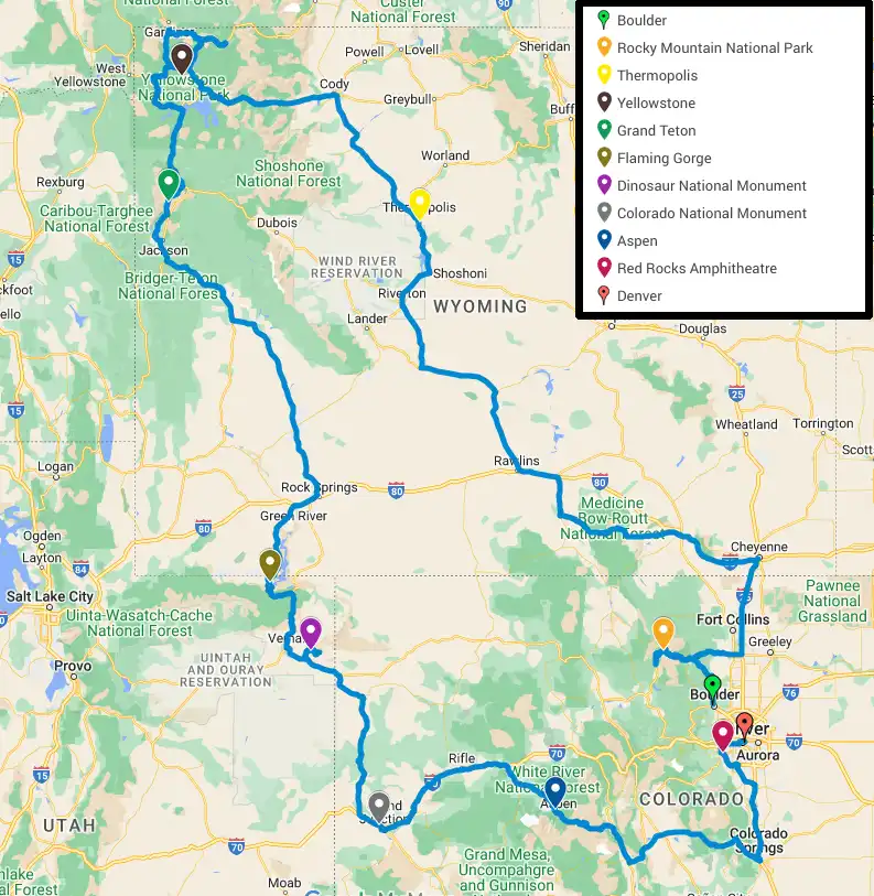
We planned a trip through Rocky Mountain, Yellowstone and Grand Teton National Parks.
At first we didn’t really know how to do the sleeping arrangements, whether we would sleep in the car, in a tent or somewhere under a roof. We were considering whether to rent a motorhome or a normal car. The motorhomes we found were mostly big and also quite expensive. In the end, we decided to rent a normal car and bring an extra checked bag with a tent and sleeping bags (a big carry-on backpack would be enough without them). Renting a car in the US for Europeans is quite a complicated topic, I wrote a separate article about it.
Fortunately, in early April we remembered to look into accommodation options in the national parks - we found that sleeping is only allowed in campsites and sites need to be booked well in advance. Four months before our departure, most of the places were already sold out. Fortunately we managed to get some of the last places, although we had to adjust our dates a little. Our biggest problem was with the Rocky Mountain National Park campgrounds, which were completely booked for the weekend dates (the largest campground, Moraine Park, was closed for renovations). Fortunately, the last few spots open up 14 days in advance, and we were able to book one of them quickly (it was a mouse clicker race, familiar to students when registering for classes, within a minute they were all gone). We also booked the campgrounds outside the parks and other accommodations (motels, Airbnb) ahead of time, but there are plenty of those available, so that wasn’t a problem.
My Czech friend moved to Colorado a while ago, which had several advantages. We had the opportunity to see each other again, stay at his place for a few nights, and we could have supplies delivered to him for the trip. A couple of weeks before we left, we ordered a large purchase of camping (dehydrated) food, oatmeal for breakfast, and a few other necessities through Amazon and REI. By the way, you can have things delivered without a friend on site, as delivery boxes and locations to have things shipped are proliferating in the US as well.
In addition, we had to get ESTA, which is a permit to enter the US, before we left. This entailed filling out a long and tedious form and paying a fee of $21 per person. We also bought a data eSIM ahead of time so we could use our phones right after landing.
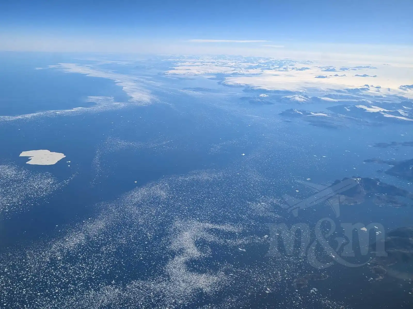
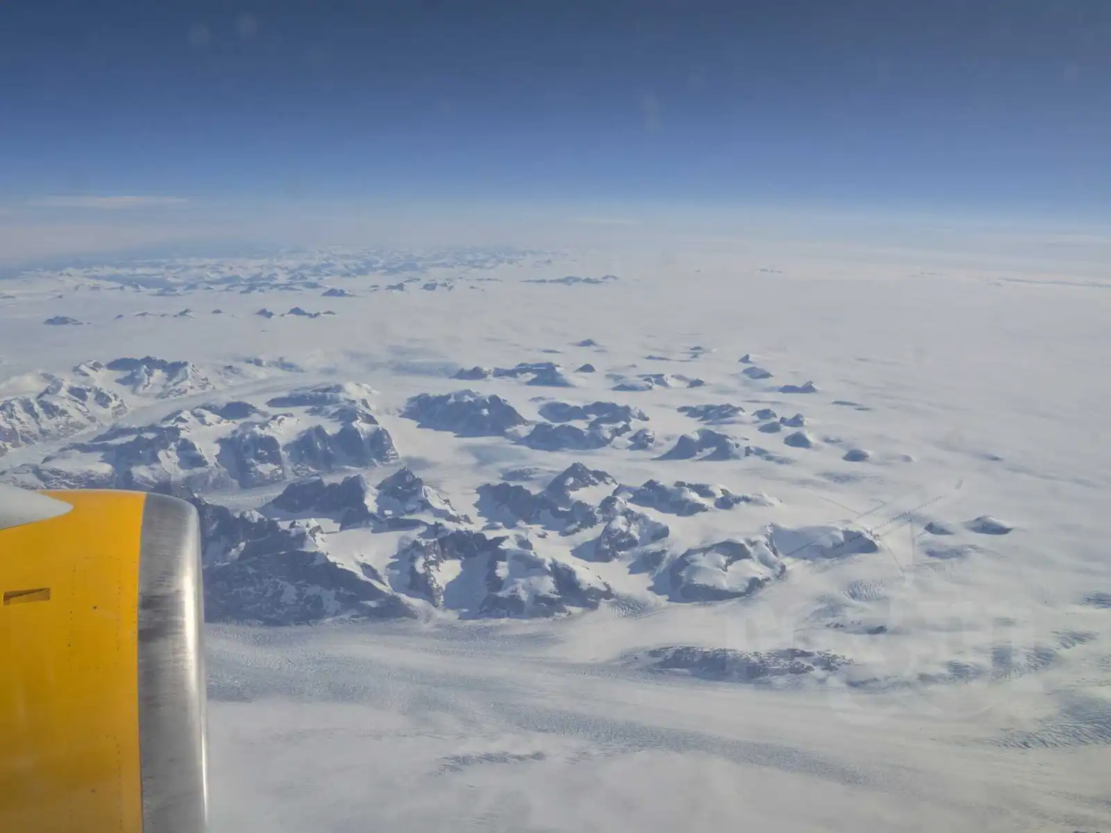
With all the preparations done, we headed to the Prague airport one Wednesday afternoon in July. We flew Icelandair to Keflavik and after a short layover, continued on to Denver. In Keflavik, we managed to grab some great cinnamon rolls between transfers. It was mostly cloudy on the flight from Keflavik, but we were lucky because the clouds parted over Greenland and we were able to admire the breathtaking view of the glacier.
First days - Boulder, Colorado
We landed at Denver International Airport in the evening, just as it was starting to get dark. We passed through passport control with no problems. It included a scan of all our fingerprints and a brief interview with an immigration officer. After collecting our luggage, we headed for the bus to Boulder. For $10 we bought a 24-hour pass for all public transportation in the Denver metropolitan area (RTD Denver), which, fortunately, works quite well. We boarded the AB1 bus, which took us directly to Boulder in about an hour.
In Boulder, we stumbled off the bus and walked to our friend’s house, who was waiting for us with a pint of Pilsner Urquell in his hand - how else to welcome Czechs on the other side of the world. The ordered supplies were already waiting for us at his place. We chatted for a while and then went to bed. But we didn’t get a great sleep that night - it was hot at night and the jet lag got to us.
We started the morning with a typical American breakfast in a nearby diner. We ordered pancakes and coffee. The pancakes were huge, really sweet and greasy. The coffee was refilled from a pot that the wait staff carried around the tables. We felt like we were in an old American movie. Unfortunately, Magda’s stomach is not used to such a heavy breakfast, so she got sick after eating. We spent the rest of the morning recovering in a nearby park. Fortunately, it didn’t take long.
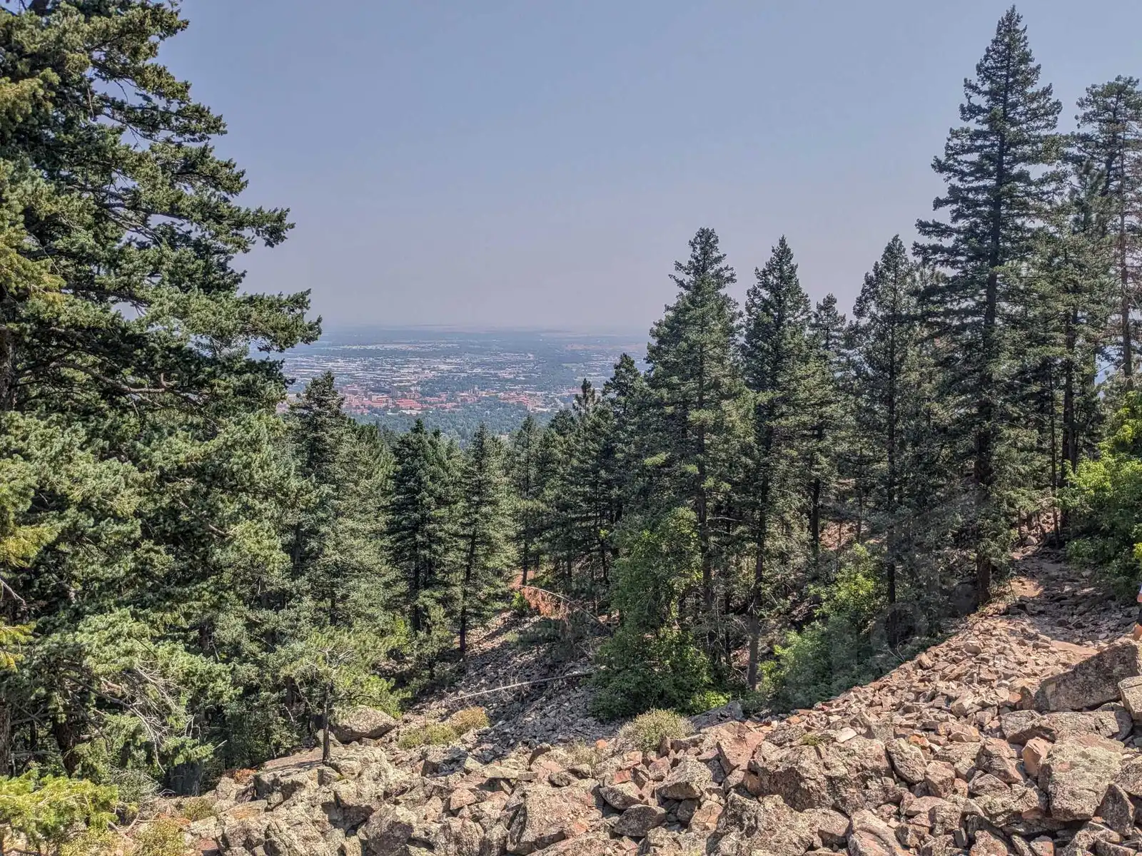
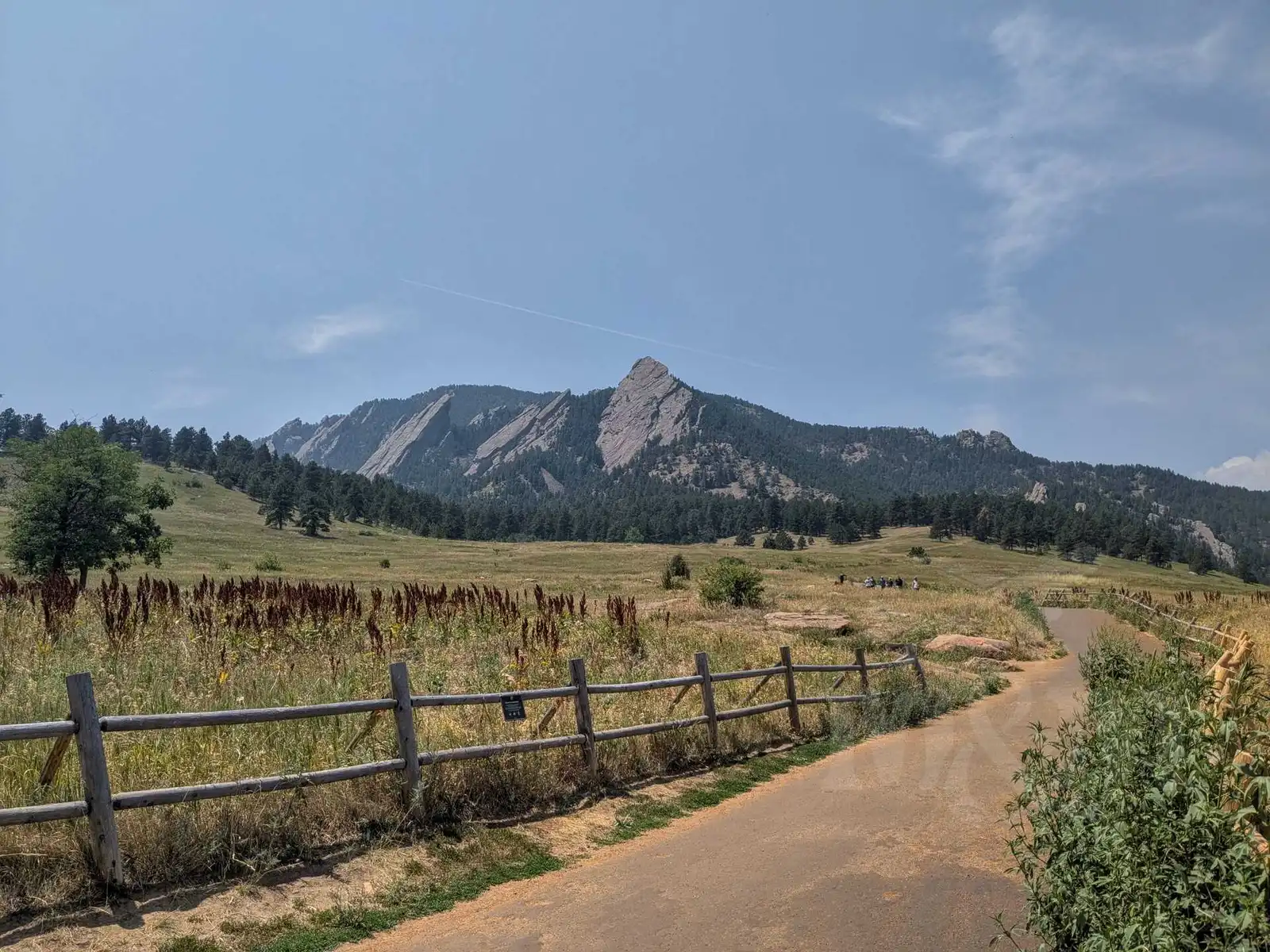
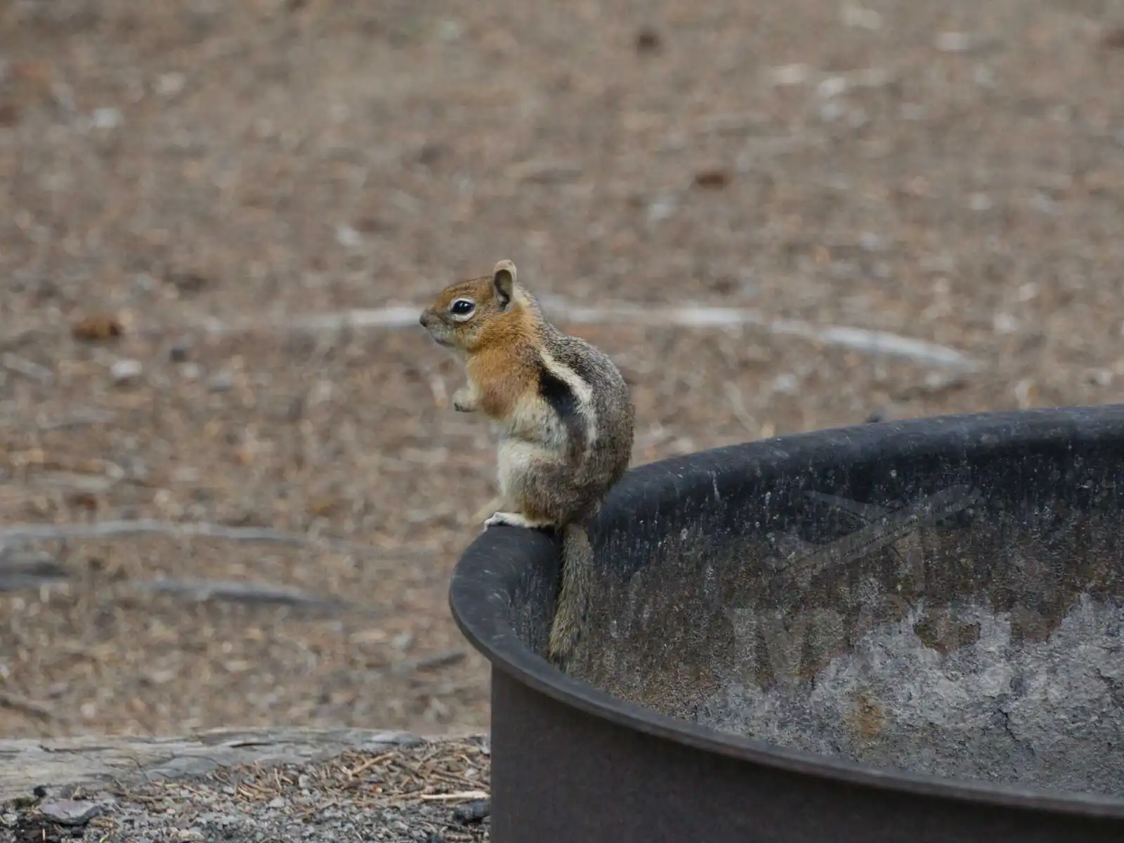
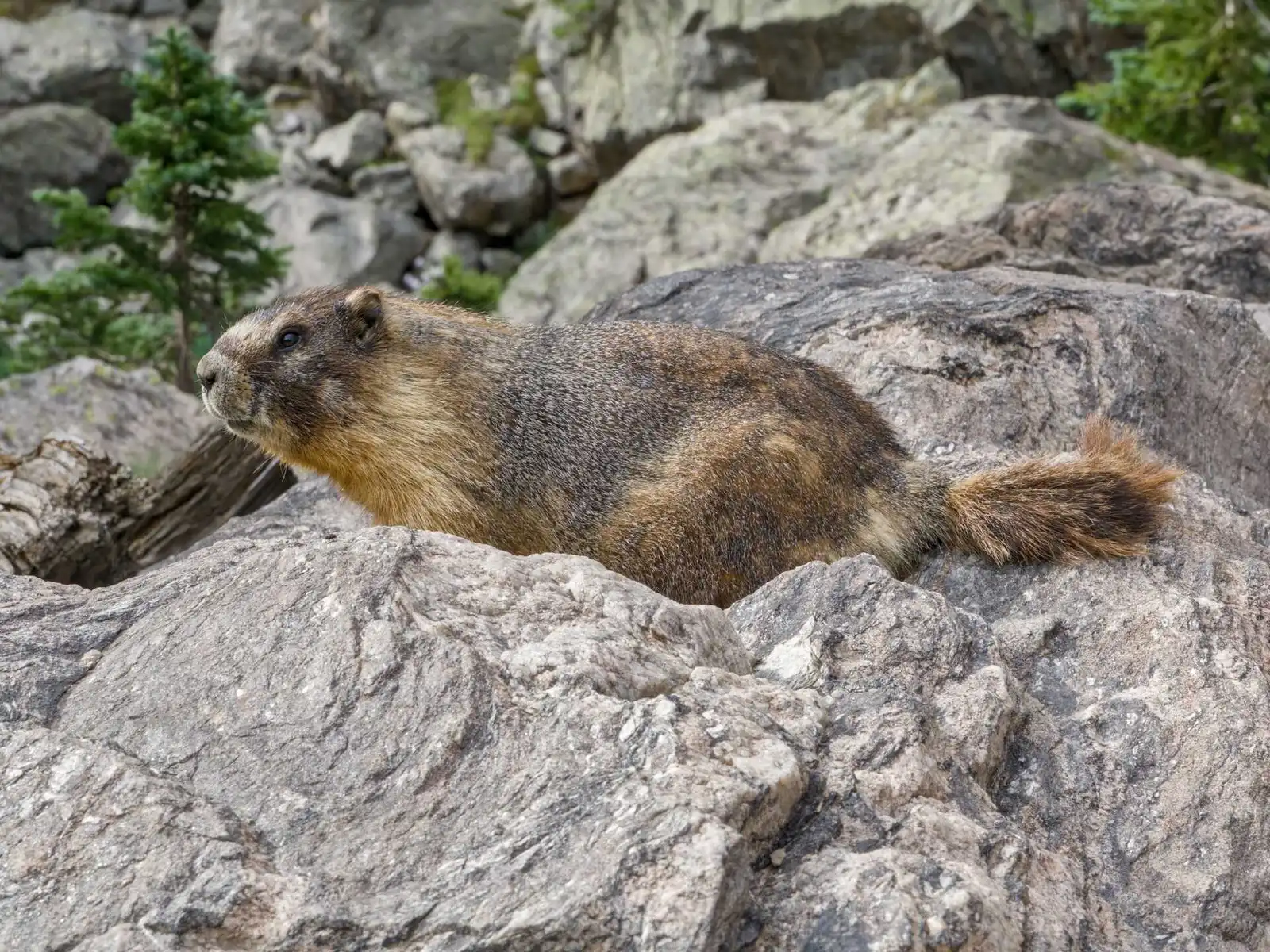
After that we went to Chautauqua Park, which is on the outskirts of Boulder. We took an Uber for a few dollars to get there. This park offers a beautiful walk through the woods to the cliff tops above town. But some parts of the trail were closed, it was hot and we were still pretty tired, so we opted for a shorter route. It was still very pretty and we had our first opportunity to see chipmunks. After the walk, we had a quick snack in the park and then walked through Boulder towards Boulder Creek and the local public library.
As we walked, we realized how useful street numbering is in the US - from 8th to 12th Street is easy to navigate. At least at Boulder Creek we could refresh our feet in the heat. And what really surprised us was the local library. It’s a modern and spacious building with a great selection of books, which surprised us a lot in America - we didn’t expect the public services to be of such a high standard.
We took an Uber to the Hertz rental car place where we had reserved a car. Renting the car was quick because we had all the documents ready. However, the same could not be said for the German couple at the next counter - the man had probably forgotten his driver’s license at the hotel. He offered to leave his wife there as collateral and come pick it up in the rental car, but unfortunately that wasn’t good enough for the staff, so they didn’t get the car. They had to come back later.
We got a nearly new Chevrolet Malibu that only had 10,000 miles on it (we added another 2,219 miles on our trip). I had to get a little used to the American traffic lights, which are located behind the intersection instead of in front of it, and the ability to turn right on red. Fortunately, it was no big deal. After we picked up the car, we stopped at an outdoor shop to pick up a gas cannister for the stove (that cannot be shipped).
After returning to my friend’s house with the rental car, we visited downtown Boulder later that evening, where we had dinner with him and his American girlfriend at a Mexican restaurant. This was our first exposure to the American tipping system. The food was fine, but the service was very slow, and we waited almost an hour for our food. Even so, it is considered normal to tip around 20 %, which we thought was a lot.
On the way back we did some more sightseeing in Boulder at night. The city had a very pleasant and peaceful feel to it. We slept (much better this time), loaded up on supplies and finally started our roadtrip the next day - we headed towards Rocky Mountain National Park.
Rocky Mountain National Park
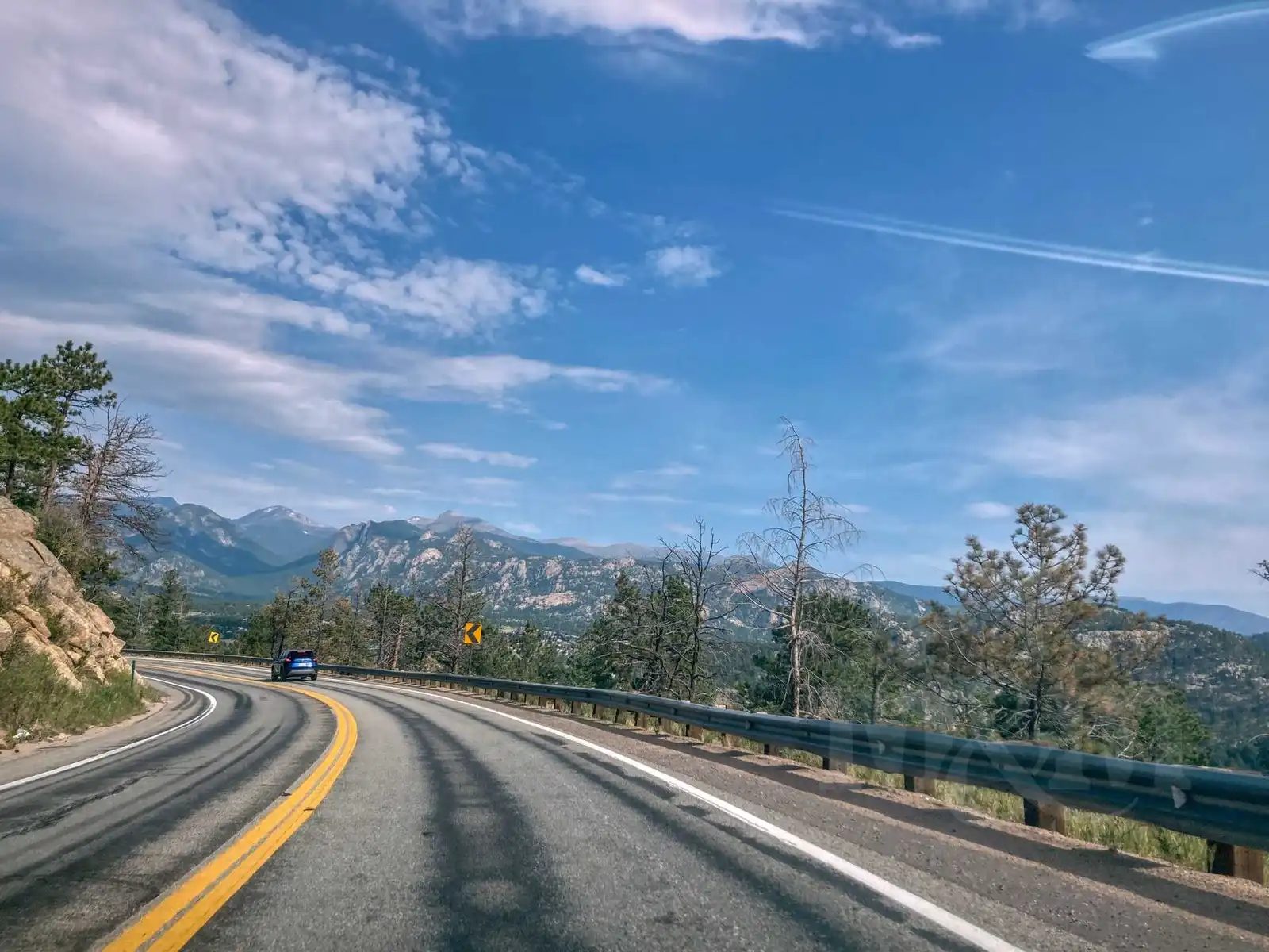
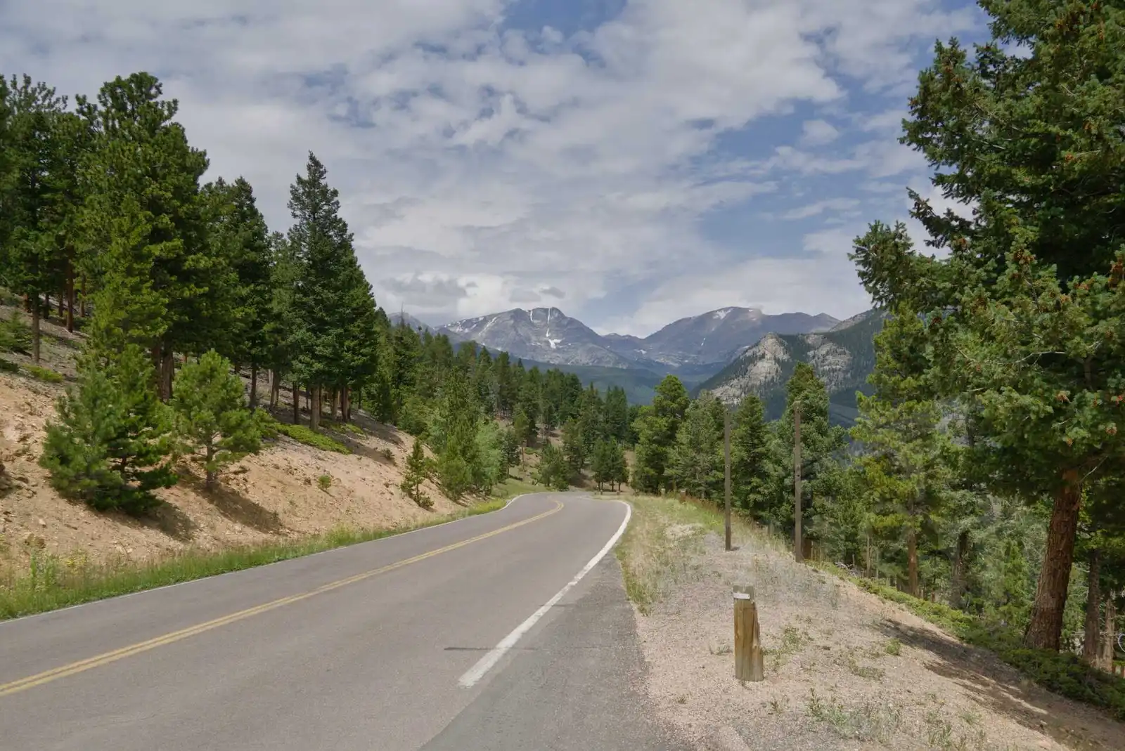
From Boulder, it’s about an hour’s drive to the entrance of Rocky Mountain National Park (RMNP) near the town of Estes Park. The road leads through beautiful countryside. RMNP is a very popular park, so much so that you must have reservations for specific hours to enter (for a fee of $2). We booked our entry between 8 and 10 am.
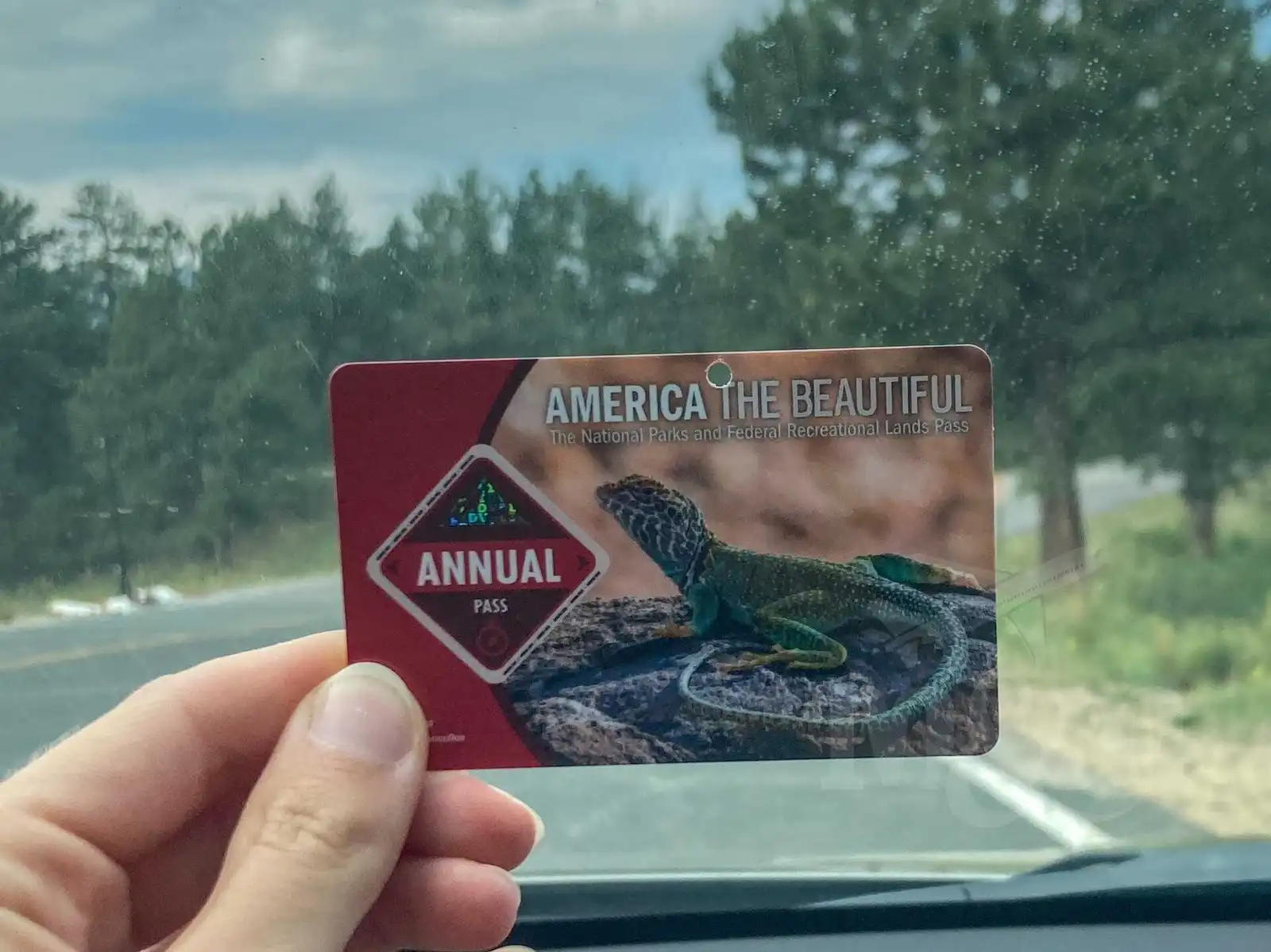
At the entrance gate, we bought an annual pass to all US National Parks (Interagency pass, America the Beautiful pass) for $80 which is valid for the whole car regardless of the number of people. We then used this pass at other parks, which ended up saving us a lot of money. We were thrilled with what the parks offered at a very pleasant price. The ranger at the gate booth also gave us a paper map of the park and a park newspaper.
Chasm Falls, Alpine Ridge Road
The park is large and is basically a drive-through, you mostly drive through it mostly and stop for shorter walks around the area. We started with a hike to Chasm Falls. We left the car in the parking lot below and continued on the unpaved road for a few miles. When we returned, we heated water on the stove and prepared lunch. There are plenty of sturdy camping tables near the parking lots, perfect for meal breaks.
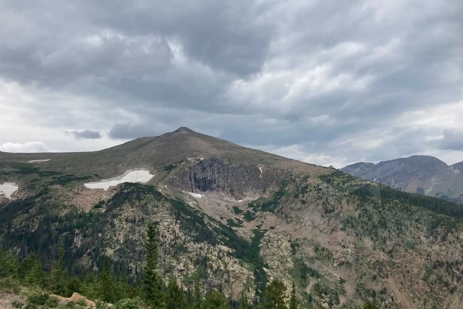
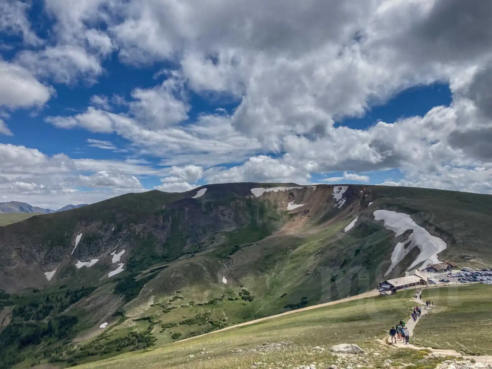
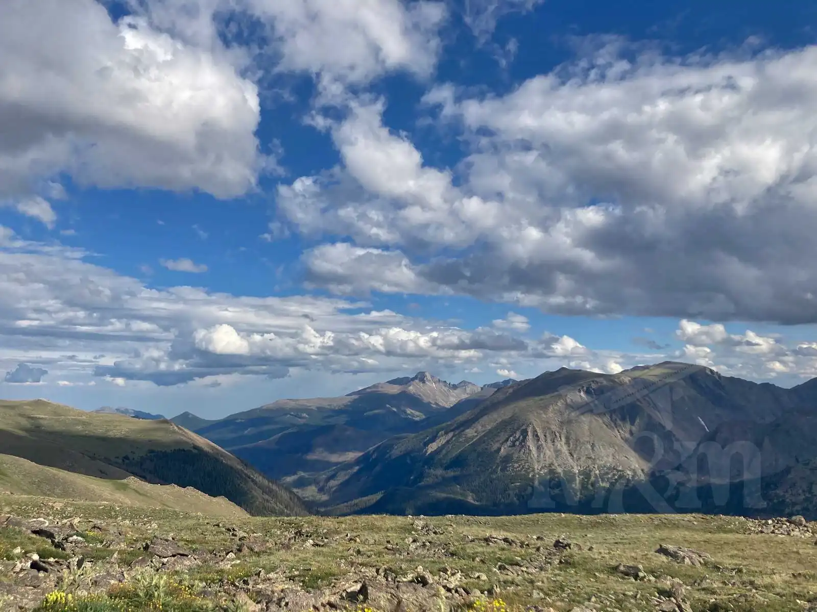
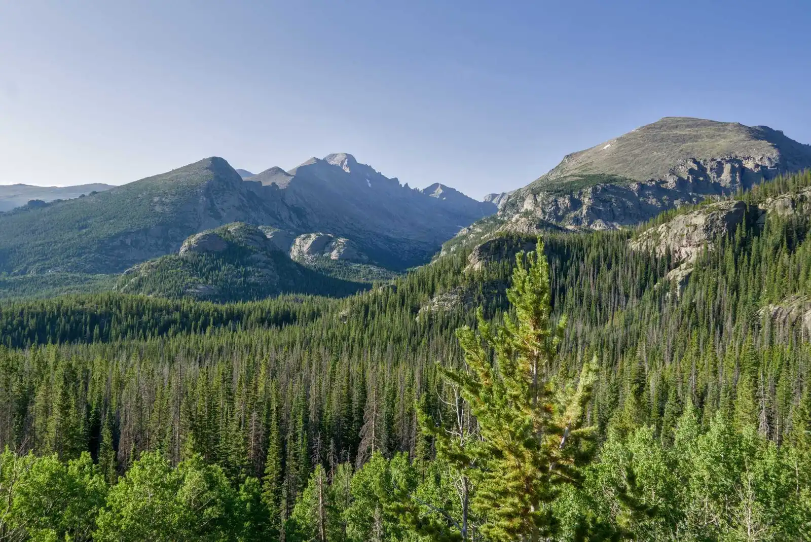
In the afternoon we continued along Alpine Ridge Road towards the Alpine Visitor Center. The climate and scenery changes quickly outside the car window - at the entrance to the park it’s about 2500 m above sea level, where it’s still relatively warm, woods and meadows. By the time we got to the top, which is at about 3600 m above sea level, there were no forests, it was cold and there was remnants of snow. Frequent photo stops are inevitable.
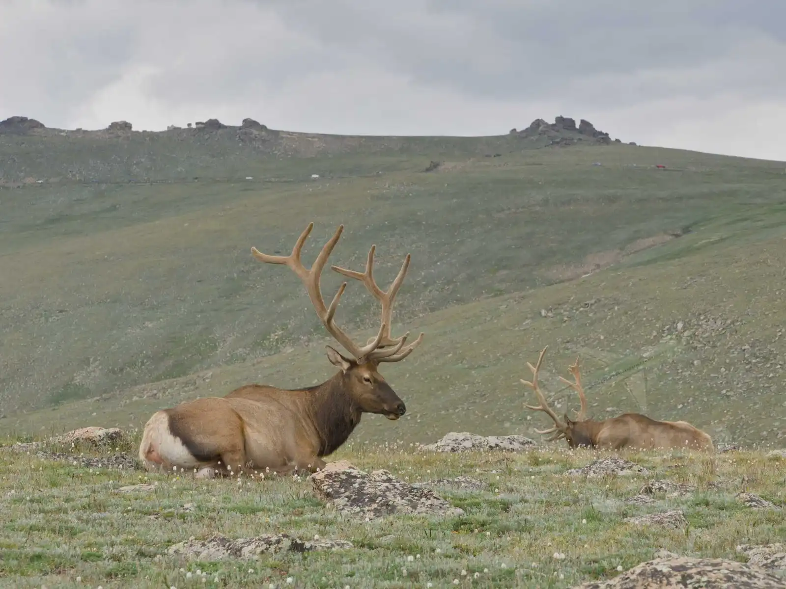
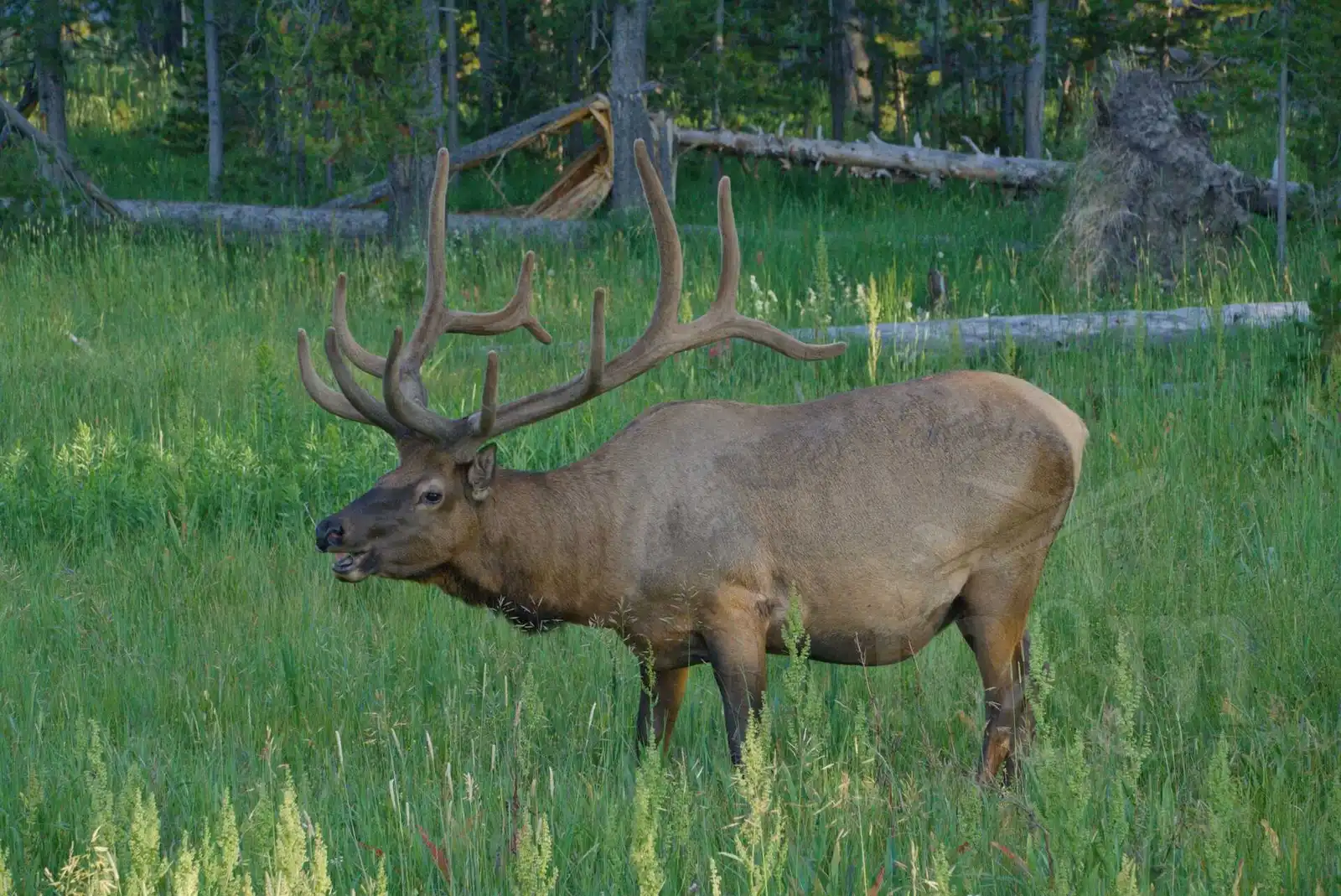
We met a group of animals along the way, which of course we also had to photograph. For a long time we thought the animals with majestic antlers were reindeer, but they were wapiti. To add to the confusion, they are referred to here as American elk, which is different from moose, which live much further to the north.
At the Alpine Visitor Center, we decided to hike up to the top of the hill, which was 12 005 feet above sea level (3659 m above sea level). That barely half a mile hike gave us a hard time.
American units such as feet, gallons and degrees Fahrenheit gave us problems throughout our time in the US. We got quite used to the units of length, but the most confusing were degrees Fahrenheit and counting volumes into cups and spoons (did you know that 3 cups is 700ml and one tablespoon?)
We bought a postcard at the Alpine Visitor Center for 60 cents, but since we didn’t have change, we wanted to pay with a card. But the lady at the counter just waved her hand and dropped some change lying on the counter into the cash register. It was a small thing, but it was nice.
From the Alpine Visitor Center we continued a little further to the other side of the mountains. We drove past picturesque Poudre Lake and crossed the Continental Divide - the watershed that separates the waterways heading to the Atlantic and Pacific. We reached the parking lot at the headwaters of the Colorado River. This river, one of the longest in the USA, starts here as a small stream. We didn’t walk very far, because we were all alone and the a bit scared of bears.
Along the way we had a little etymological discussion about the name of the river and the state. We wondered if the state was named after the river or vice versa. Subsequent research revealed that, in fact, the river is named after the state - it was originally called the Grand River and was renamed the Colorado River in 1921. The name Colorado then comes from the Spanish adjective red. And the red colour in the rocks is really visible at every turn here.
After visiting the headwaters of the Colorado River, we headed back to Estes Park and continued on to Glacier Basin Campground. There we cooked dinner, set up our tent, and put all our food safely in bear boxes so the bears wouldn’t find it (and hopefully far enough from our tent).
Bear Lake (and a lot of other lakes)
The next day we woke up very early, before 5am, because we had planned to see the sunrise at Bear Lake and take a trip to other lakes in the area. We just threw the tent and sleeping bags in the car, there was no energy for packing at this hour.
It was about a 10 minute drive to the Bear Lake parking lot from the campground. To our surprise, however, the parking lot was completely full before 6am. Weekends in the summer are really popular for trekking in this area. We were disappointed for a while when we had to drive back down. We thought we had gotten up for absolutely nothing. Fortunately, at about the third parking lot, a few miles down, we were able to find a spot. There is a shuttle bus that runs between the parking lots, and as we found out after we parked, the first one of the day was due to arrive in a few minutes. The bus arrived, we got on (it was free as part of our park admission) and it took us back up to Bear Lake.
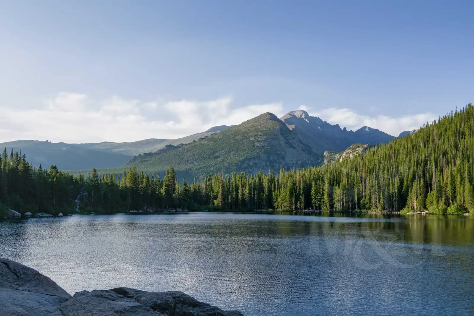
We walked around the lake, it’s very nice, especially in combination with the surrounding mountains reflected in it. We had a lot of lakes planned that day, plus Nymph Lake, Dream Lake, Emerald Lake and Lake Haiyaha. All the lakes were beautiful, each one completely different. The sun was shining in the mountains, a beautiful day. Even though we only walked about 12 kilometers, it gave us quite a workout. On the descent through Alberta Falls back to the parking lot, we had to take a break and try the dehydrated Chocolate Cheesecake mix - just pour cold water over it and wait a few minutes. It was really great.
After returning to the car, we were leaving RMNP. We still took a picture with the sign at the entrance, that seemed like a must. We then drove down the mountain to Longmont, a town just north of Denver where we had booked an Airbnb. Our host Tammy was very nice and chatty.
Cheyenne, crossing Wyoming
In the morning, we packed up our stuff, threw it in the car, and headed down Interstate-25 (for the record, odd-numbered interstates run north-south, even-numbered interstates run west-east) toward Cheyenne, the capital of Wyoming. The drive took us only an hour.
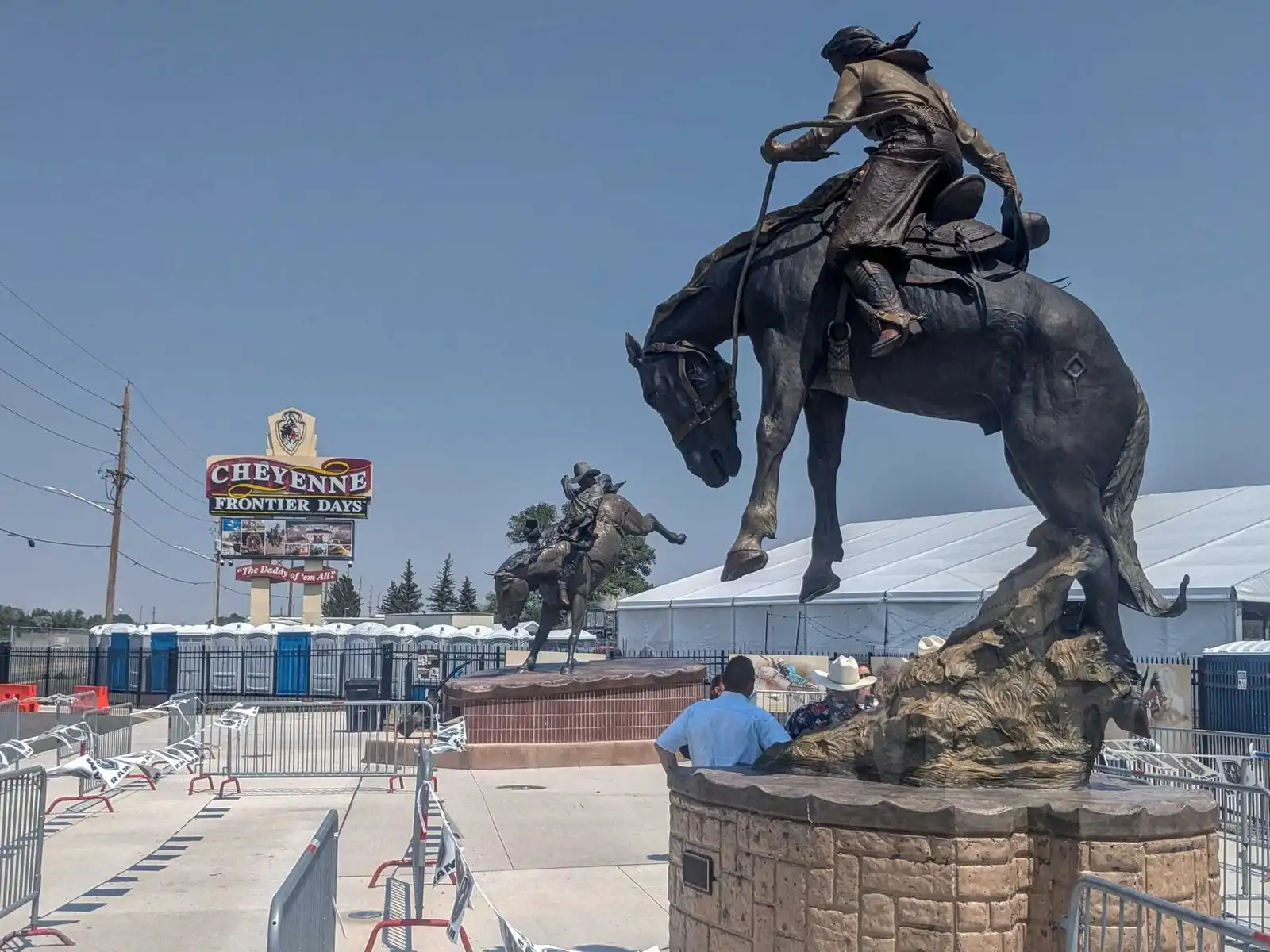
In Cheyenne we decided to stop for Cheyenne Frontier Days, a festival reminiscent of the wild west, including a rodeo. Signs near town directed us to a parking lot where we parked. Included in the price of parking ($20) was a ticket to the festival and a shuttle bus ticket to take us to the site. The shuttle buses used for transportation were the classic yellow school buses, which probably have no other use in the summer. So we enjoyed the ride on this iconic means of transportation (they have very hard seats).
We walked through the stalls and shops around the festival. I bought a hat and we had something to eat - corn wrapped in churros and sausage on a stick. In our personal competition for the most disgusting food, the grilled chicken between two donuts was the leader - we preferred not to try that… We didn’t go to the rodeo in the end, because the program lasted several hours (it started with the national anthem… just an USA thing). Other than that, though, there weren’t that many things to tempt us.
From Cheyenne, we continued west on I-80 towards Laramie. We could have gone further down the highway, but we had time, so we decided to take a side road through the mountains (Medicine Bow-Routt). Wyoming is the least densely populated state in the US, so driving on a smaller road is a special experience. In half an hour you’ll see a couple hundred cows, one half-demolished house and maybe five cars. The mountains are beautiful and photogenic. We stopped in the town of Saratoga, where there are several publicly accessible thermal pools. The water was nice, but way too warm, especially when it was hot outside. In the evening we arrived in Rawlins where we had a motel reservation.
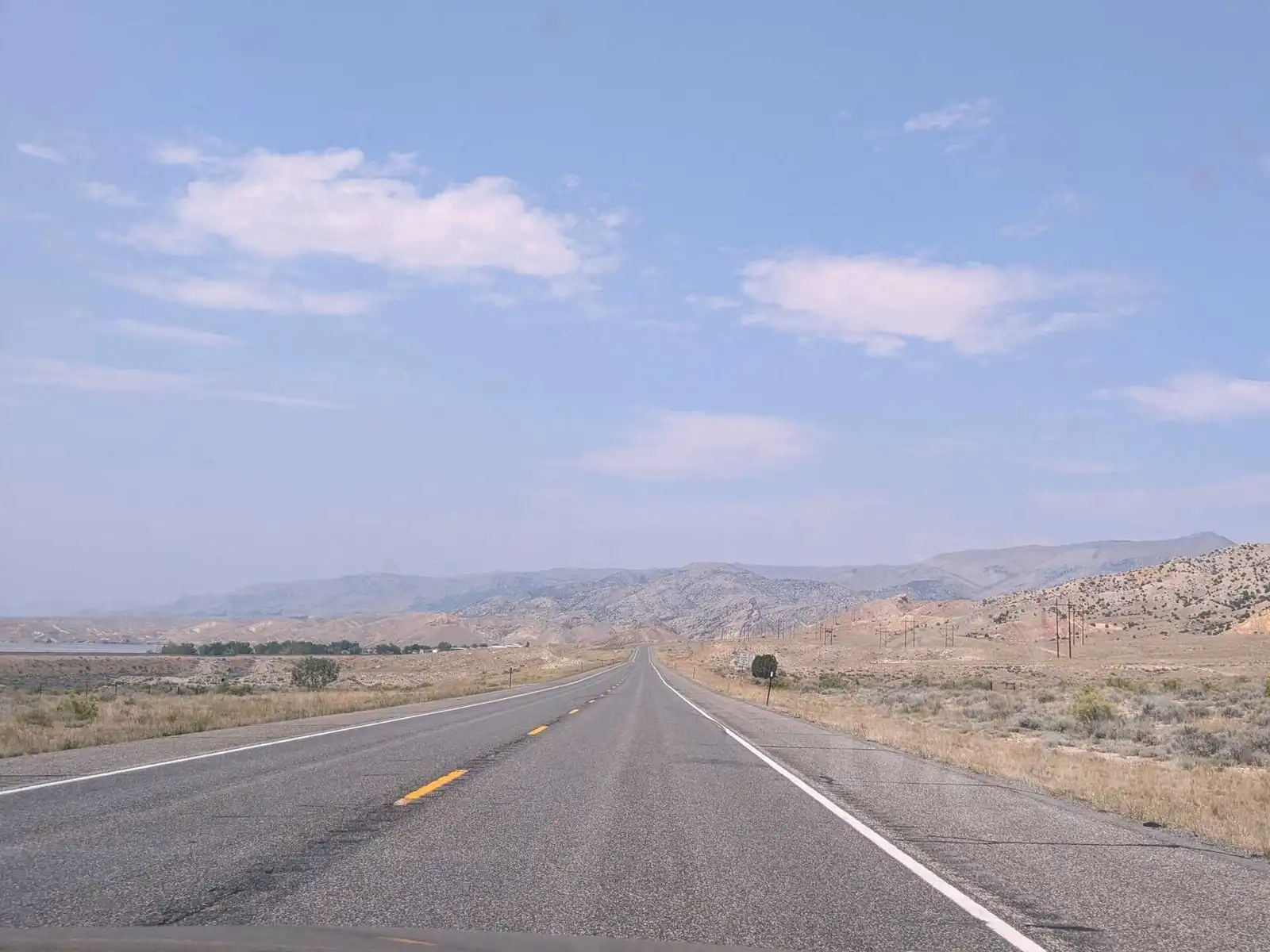
The next day we had about a four-hour drive to the small town of Cody, which lies just outside the eastern gateway to Yellowstone. We passed through the Wind River Indian Territory, which was familiar to me because of the movie of the same name with Jeremy Renner. When I saw it a few years ago, I never thought I’d visit here someday. Along the way we passed small towns that looked like their best years were a long time ago.
Due to the heat, we had planned to take a dip in Boysen Reservoir, but had to abandon that plan because a cyanobacteria warning was posted in one of the few parking lots near the water. So we continued on and made a bigger stop in the town of Thermopolis.
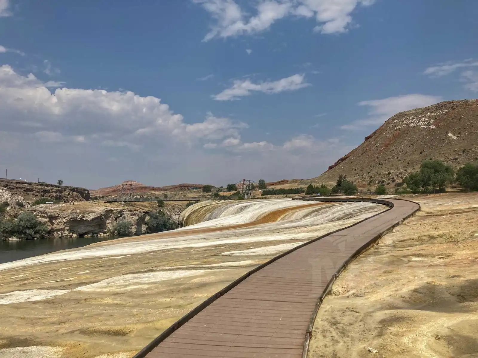
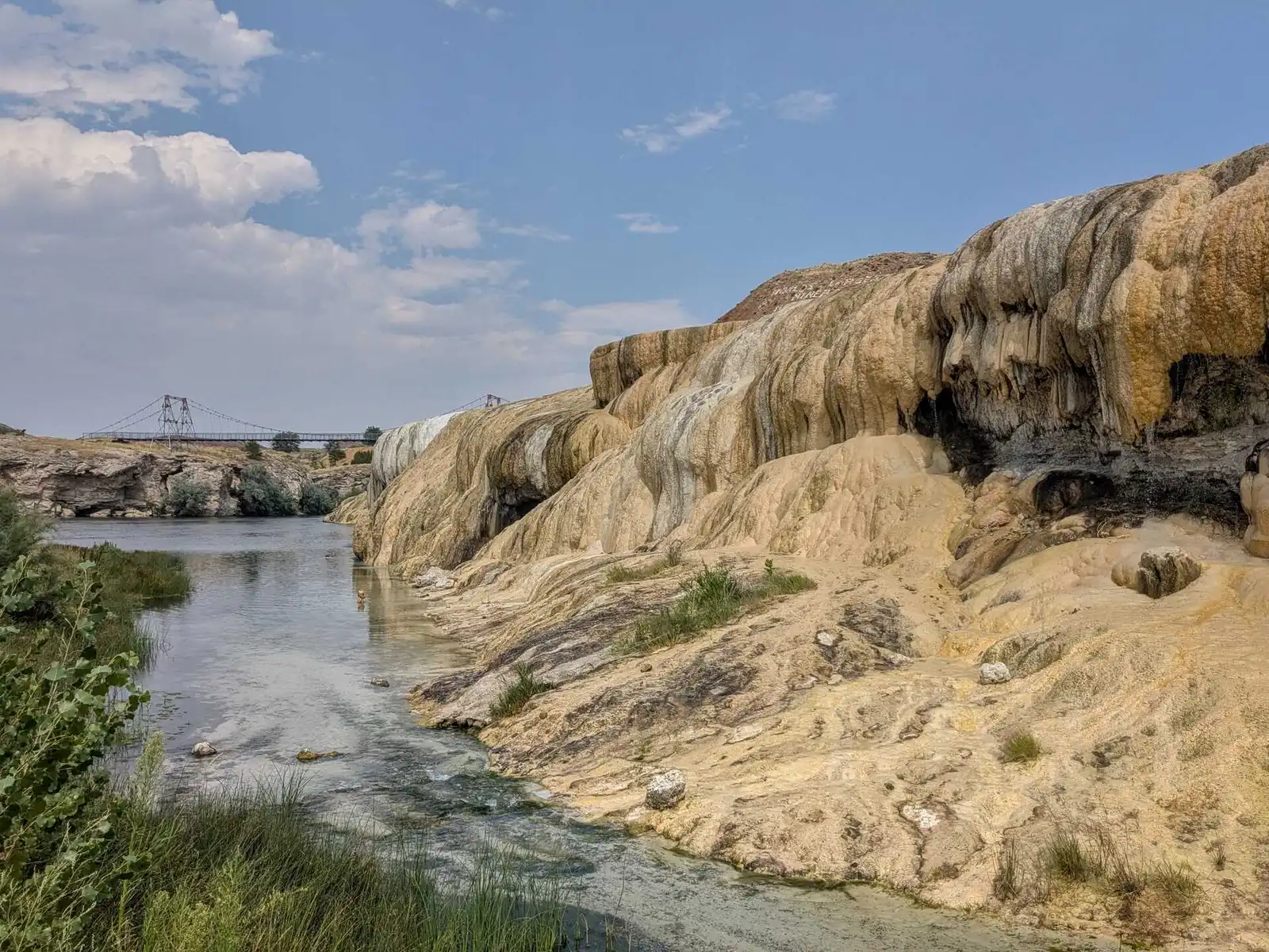
Thermopolis surprised us with the small but beautiful Hot Springs Park, which has thermal pools and a salt hill with walkways to walk on. It was a really nice place, but due to the heat we didn’t venture into the thermal pools even though they were free. The water that flowed from them was pleasant only where it flowed into the river.
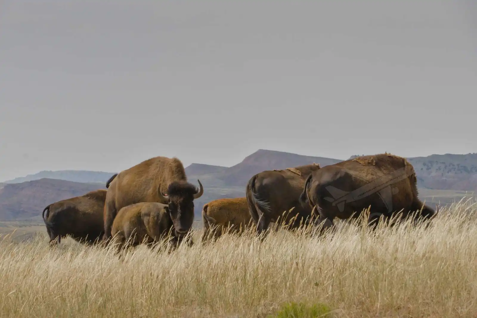
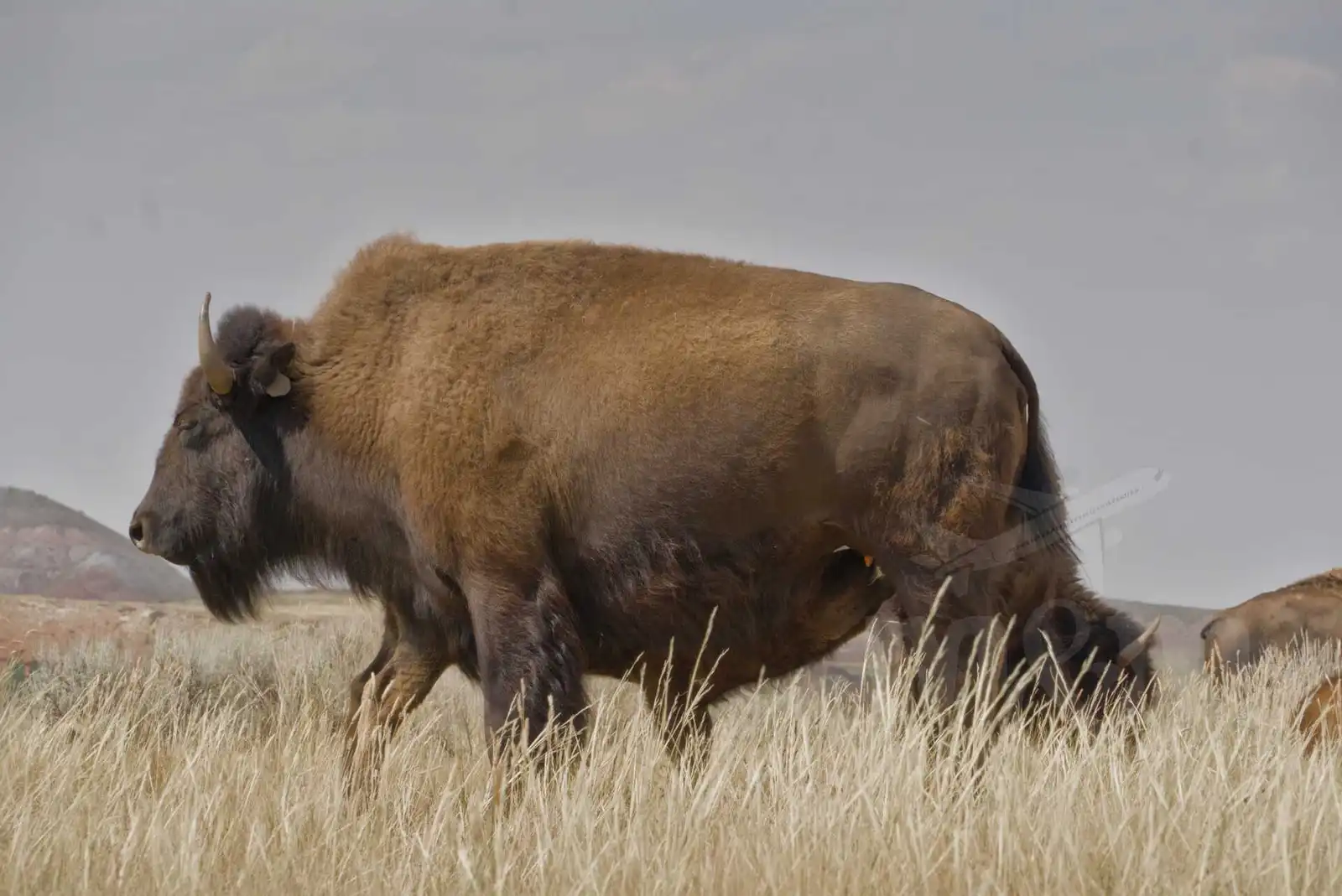
From the thermal pools we continued along the scenic road that led through the bison enclosure. Of course, we couldn’t miss this and so we finally saw our first bison. It was fascinating to watch them grazing peacefully, without being particularly disturbed by the cars from which tourists snapped one photo after another.
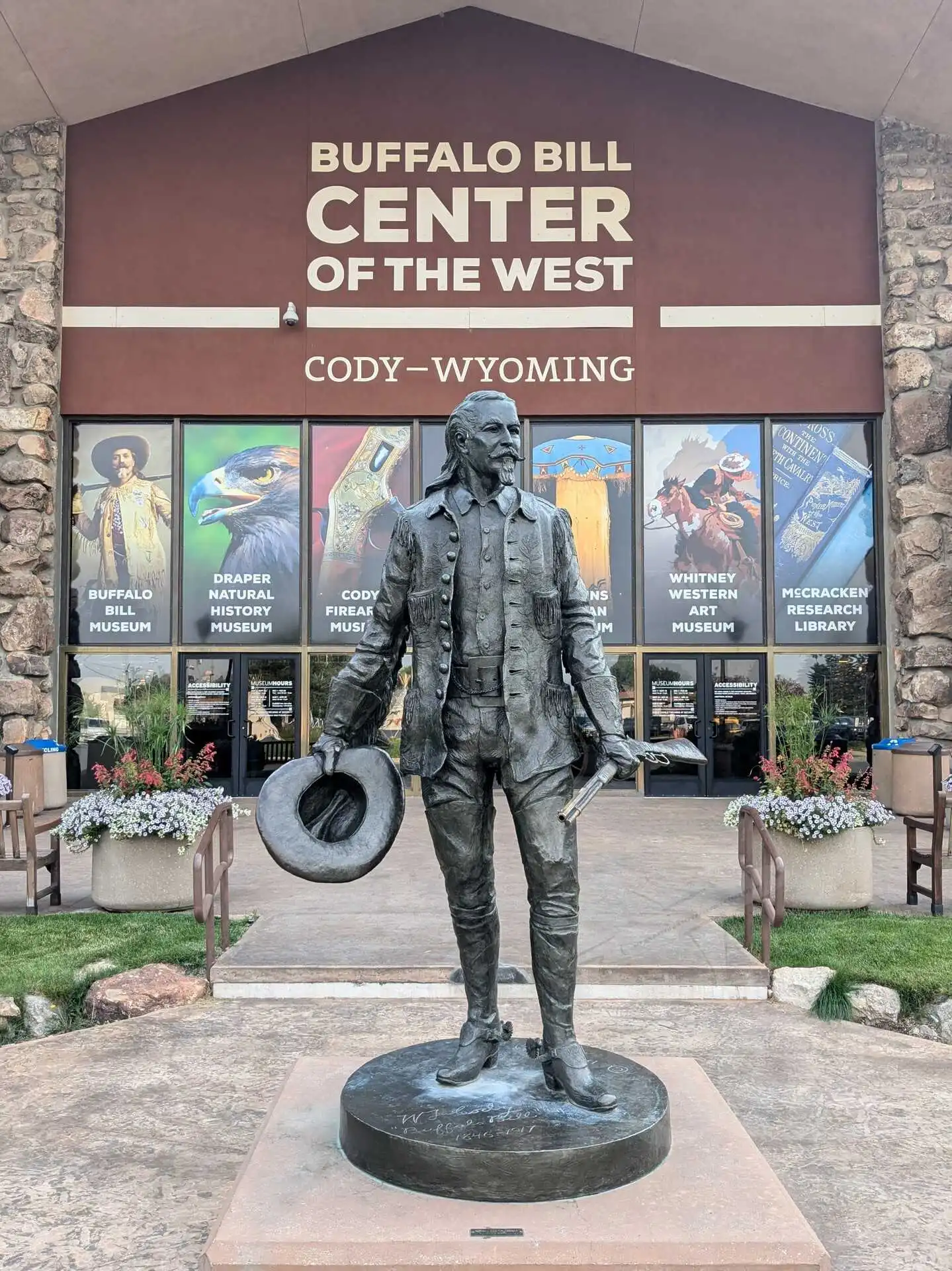
We left Thermopolis after a quick fast food meal to stave off hunger and continued on to the town of Cody. This town was founded by the famous Buffalo Bill (civilian name William Frederick Cody) - when I read books about Buffalo Bill as a kid, I never thought I would ever get that close to this history either.
We arrived in Cody in the evening, took a photo in front of the Buffalo Bill Museum. We didn’t go inside, both because we were there shortly before closing time and because the admission fee seemed pretty high. In Cody they try to make the most of Buffalo Bill’s legacy, every second store references it. There are short western skits playing in front of the Irma Hotel (also founded by Buffalo Bill). We watched one of them, but didn’t quite like the patriotic charge (with the national anthem and flag) and the emphasis on gun rights. We thought the whole thing was a bit silly. After all, the whole history of the Wild West is pretty controversial from today’s perspective.
We spent the night just outside of Cody on a farm in the Sheep Wagon glamping site. We slept comfortably and in the morning after filling up the car we headed towards the entrance to Yellowstone.
Yellowstone
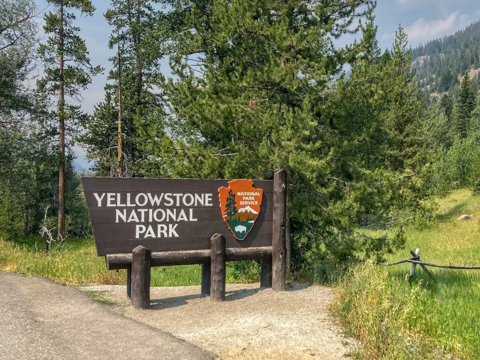
We arrived at the east entrance to Yellowstone just before noon. After the obligatory photo at the Yellowstone sign we continued towards Yellowstone Lake. The park is really large, so the drive to the lake alone takes over an hour. The drive through the forests and meadows was beautiful and we looked for bears along the way.
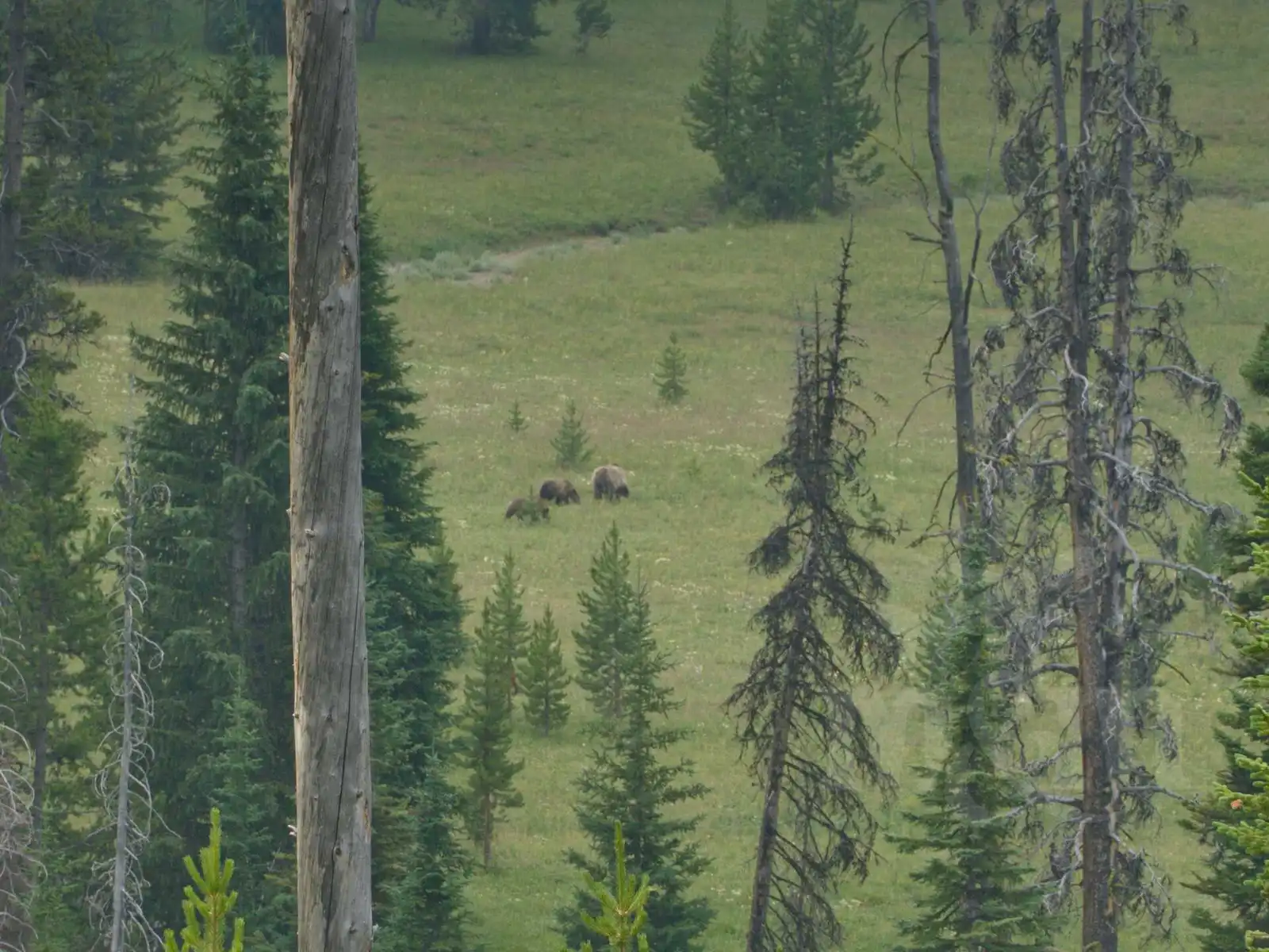
We stopped just before the lake because of the large number of cars parked on the side of the road and people with binoculars and huge telephoto lens cameras. It was clear they were watching something interesting. So we stopped too and went to take a look. We did indeed see a grizzly bear with two cubs in a meadow in the distance. The rangers on site were organizing traffic and showing people where to look. We did see 3 dots in the distance, but we didn’t really see them clearly until we were in the camera (because we forgot our binoculars). We never saw a grizzly any closer.
Mud Volcano, Grand Canyon of Yellowstone
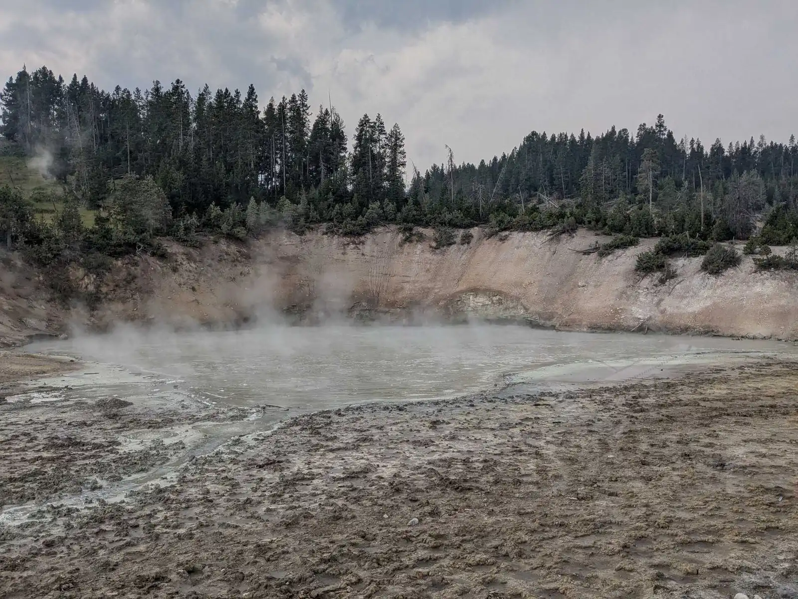
After arriving at the lake, we turned right and continued towards Canyon Village. On the way we had our first stop at Mud Volcano geysers. As the name suggested, the place was not full of typical geysers, but rather bubbling mud puddles that looked a bit different than we had imagined. Still, it was an interesting stop and walk.
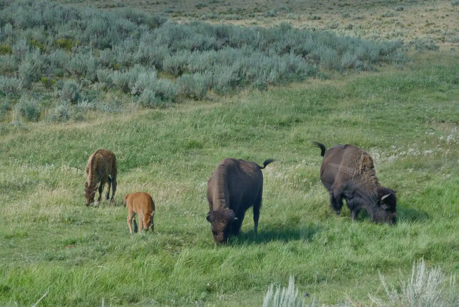
We stopped a bit further on for a photo with a bison resting near one of the geothermal craters. We met many more bison after that, and gradually began to see them in such numbers that we got tired of stopping for each one.
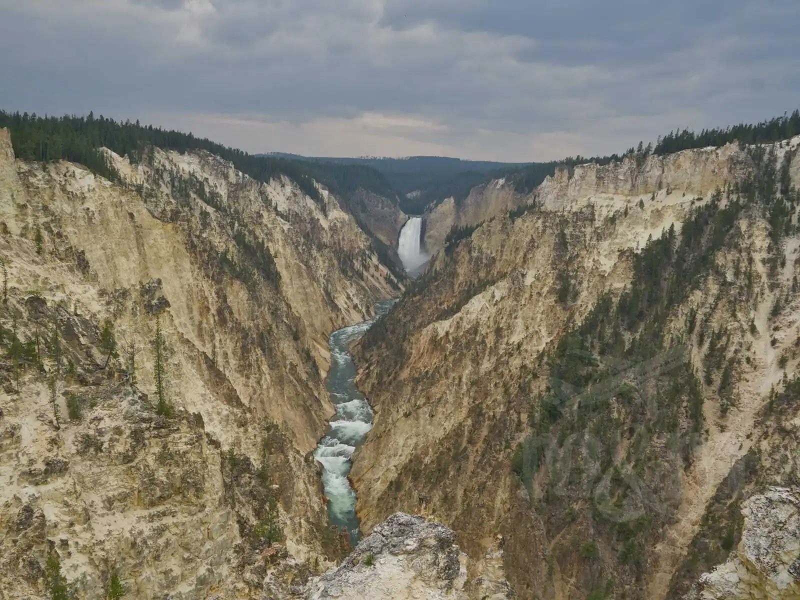
A little before Canyon Village we turned onto South Rim Drive, where you can see 2 waterfalls on the Yellowstone River and then also a view of the breathtaking Grand Canyon of Yellowstone. We parked in the first large parking lot on the left and walked along the path along the rim of the canyon to Artist Point Overlook. The views were definitely worth it.
Upon arrival at the Canyon Village campground, we found our reserved campsite. Canyon Village is the focal point of the park with shops, restaurants and a gas station. You can also get a cell signal here, which is not available in most of the park… The campground was divided into several smaller areas in the woods, each with a circular one-way road and campsites along it. Shared (flush) toilets were roughly in the middle of each area.
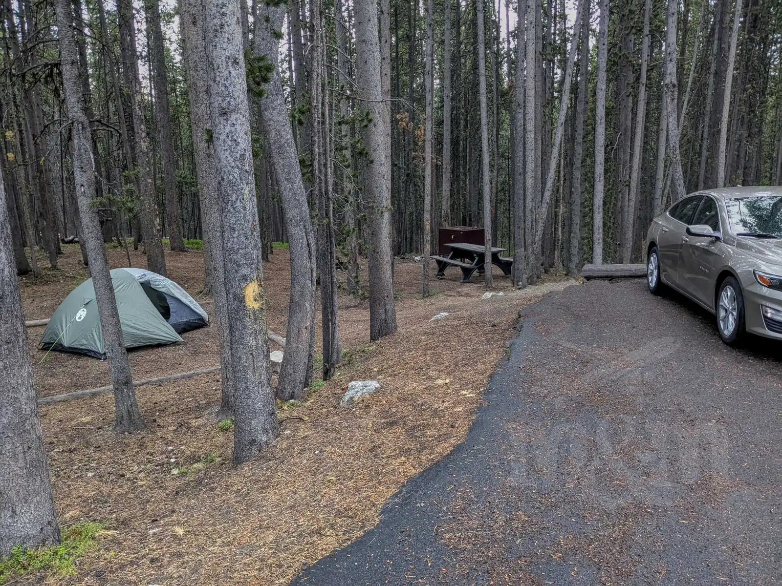
We set up our tent, prepared our food and then thoroughly enclosed everything in the car and bear box to prevent any possible encounters with bears. It rained at night and was really cold, which we didn’t expect. We put on all the layers we had. The campsites are quite large, far apart and you have a lot of privacy. The only light is at the toilets, though. Going to the toilet at night with a headlamp (about 300m away) is quite a test of courage.
Norris, Mammoth Hot Springs, Lamar Valley
In the morning when we woke up it was cloudy, wet everywhere and still quite cold. We left our tent at the campsite as we slept there for two nights. We had planned a loop through Norris, Mammoth Hot Springs, Tower, Roosevelt and back to Canyon.
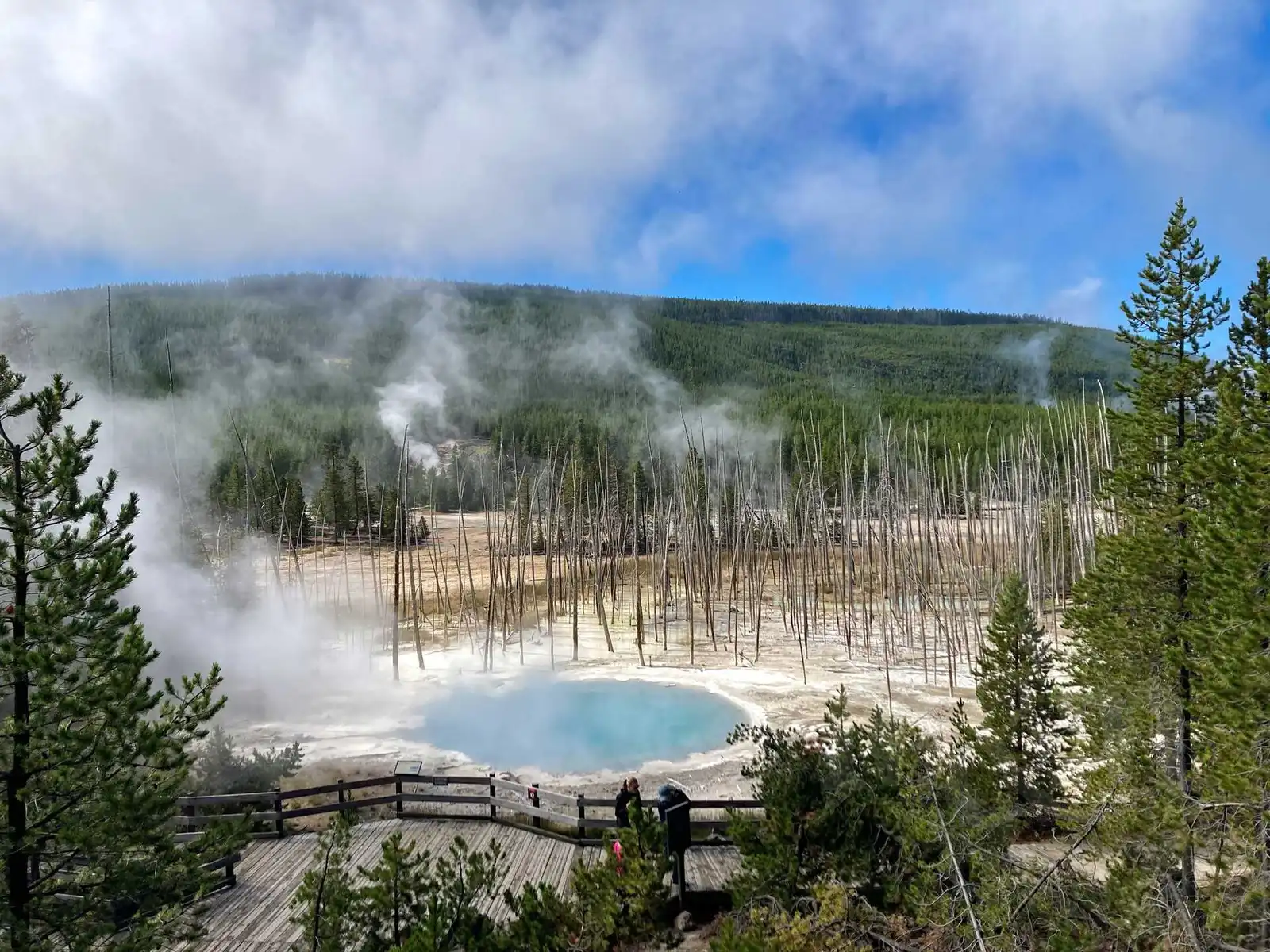
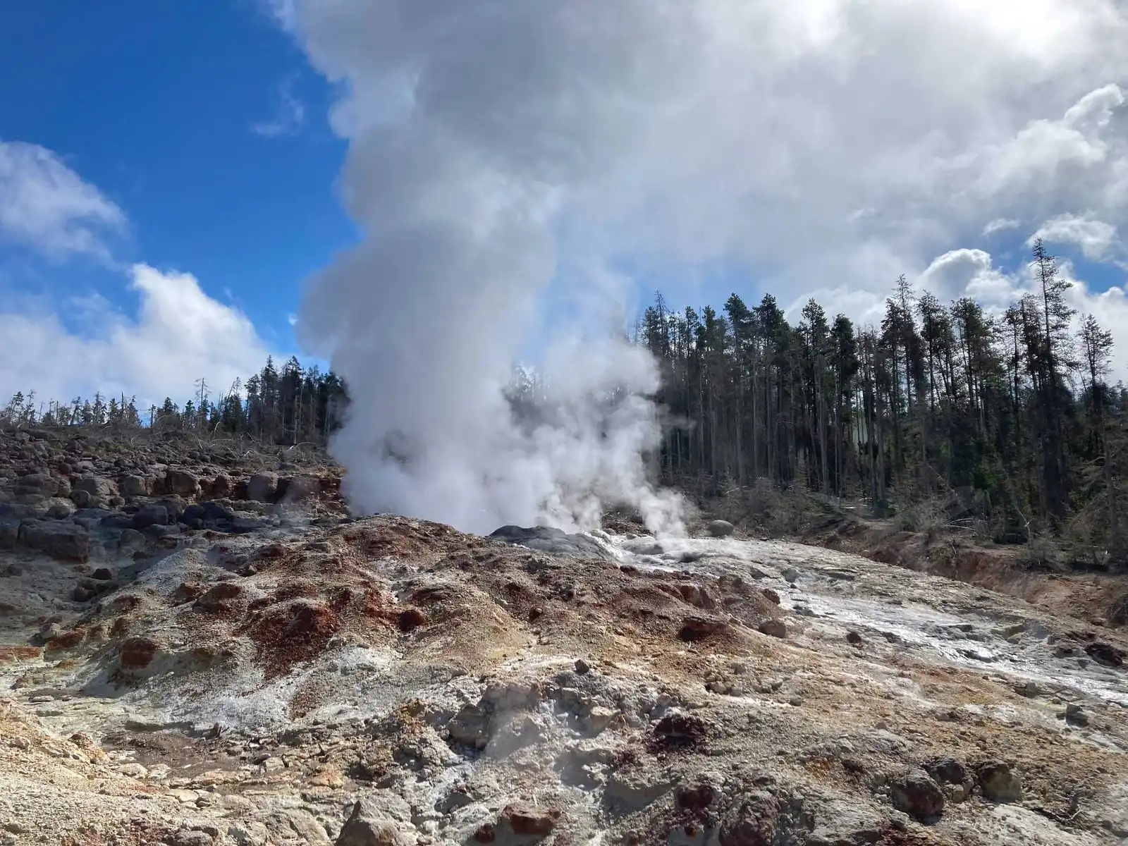
As we drove through the woods to Norris, the clouds broke and the sun showed up at times. When we arrived at the Norris Geyser Basin, it was still foggy, which had one advantage - there weren’t that many people in the area. We walked all the circuits. We liked the Back Basin tour better, where we admired the colorful Cistern Spring and the fascinating Steamboat Geyser, the tallest active geyser in the world. Unfortunately, it didn’t spout during our visit. Even so, all the geysers and lakes in the area were stunning, with gorgeous shades of blue, green and orange.
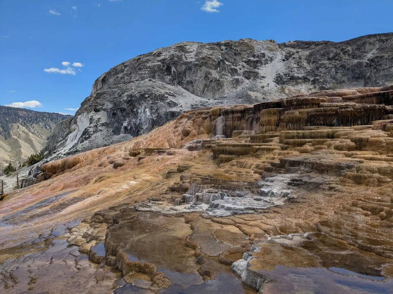
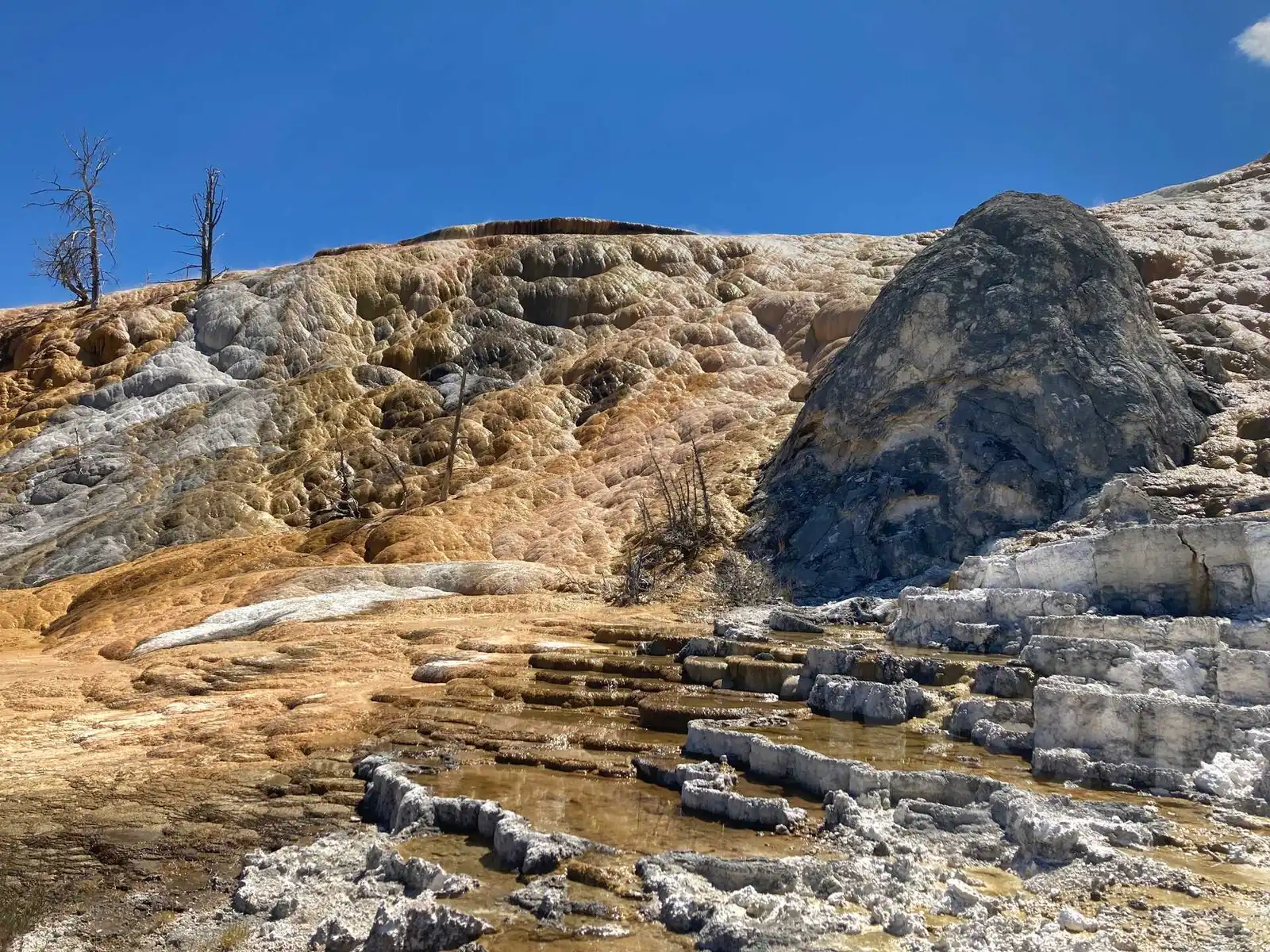
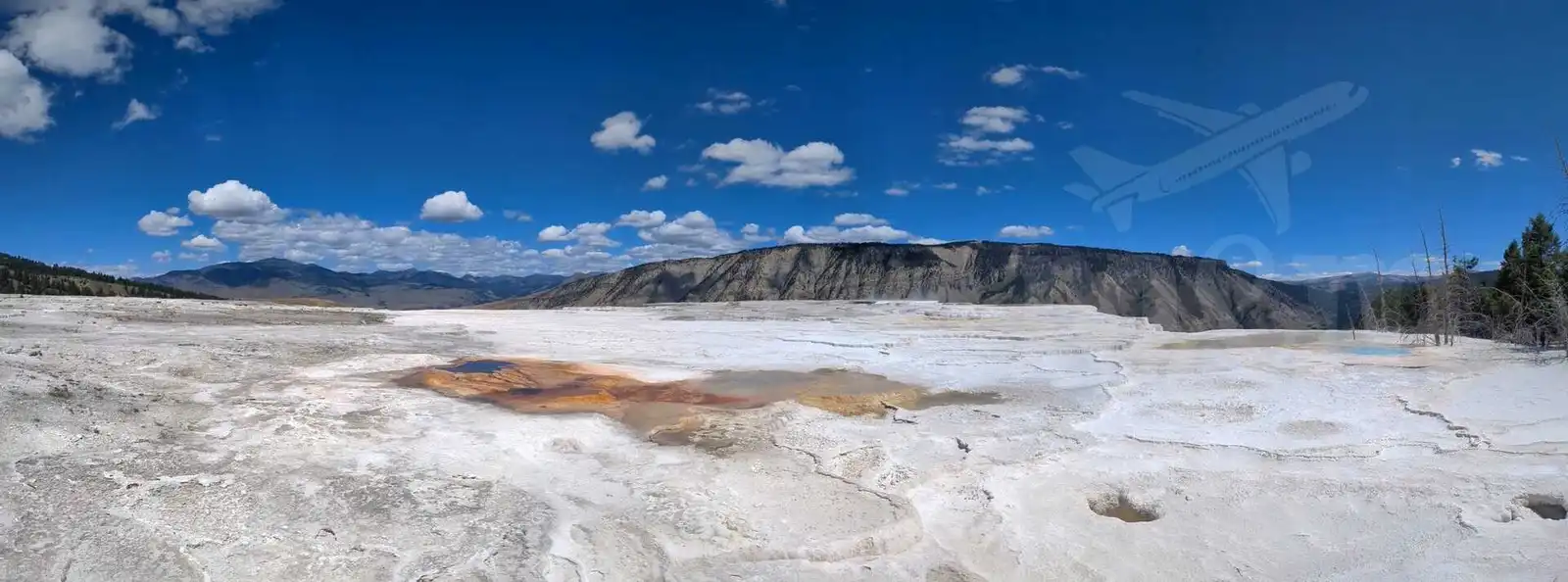
After the tour, we visited the nearby Ranger Museum, which provides interesting information about the origins and conservation of the park. We then proceeded to Mammoth Hot Springs, where we were amazed by the mineral-covered terraces on whose slopes the flowing water creates cascades of sediment.
After leaving Mammoth Hot Springs, we decided to take a peek at Montana for a while and headed north. Not wanting to leave the park, we hoped that at least some sign marking the state line would offer us a photo opportunity, but there was nothing. Just a winding road and tall mountains on the horizon. But according to the map, we were already in Montana, so it counts.
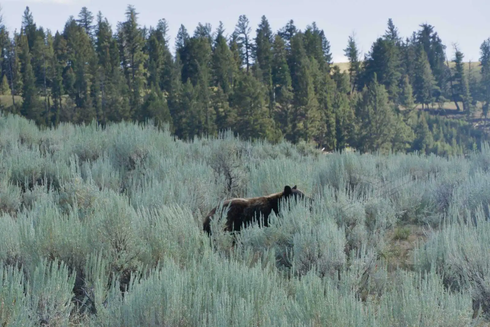
We were pretty tired and didn’t feel like walking any further, so we more or less did our next trip from the car. We turned off at Tower - Roosevelt and drove through the Lamar Valley, which is famous for great animal watching opportunities. And as we found out, there were a lot of animals. Bison walked on both sides of the road and sometimes even crossed right between cars. It was amazing, so even though we told ourselves we wouldn’t take any more pictures of them, we just couldn’t resist here.
At one point we even saw a brown bear walking near the road from the window. The photo is from a bit farther away than it could have been, because instead of taking a picture Magda was furiously closing the window first.
In the evening we returned to the campsite in Canyon Village. We used the shower, which is at the entrance to the campsite and is included in the price. Fortunately it wasn’t as cold that night.
Firehole Lake, Grand Prismatic, Old Faythful
The next morning, after packing up our gear, we headed towards Norris again, but this time we took a left and headed towards Madison and Old Faithful.
After Madison, we turned onto Firehole Lake Drive, a side road where you can stop, walk around the hot lake and see a few geysers. We came to one of them, White Dome Geyser, just as it started spewing water - it’s an impressive sight.
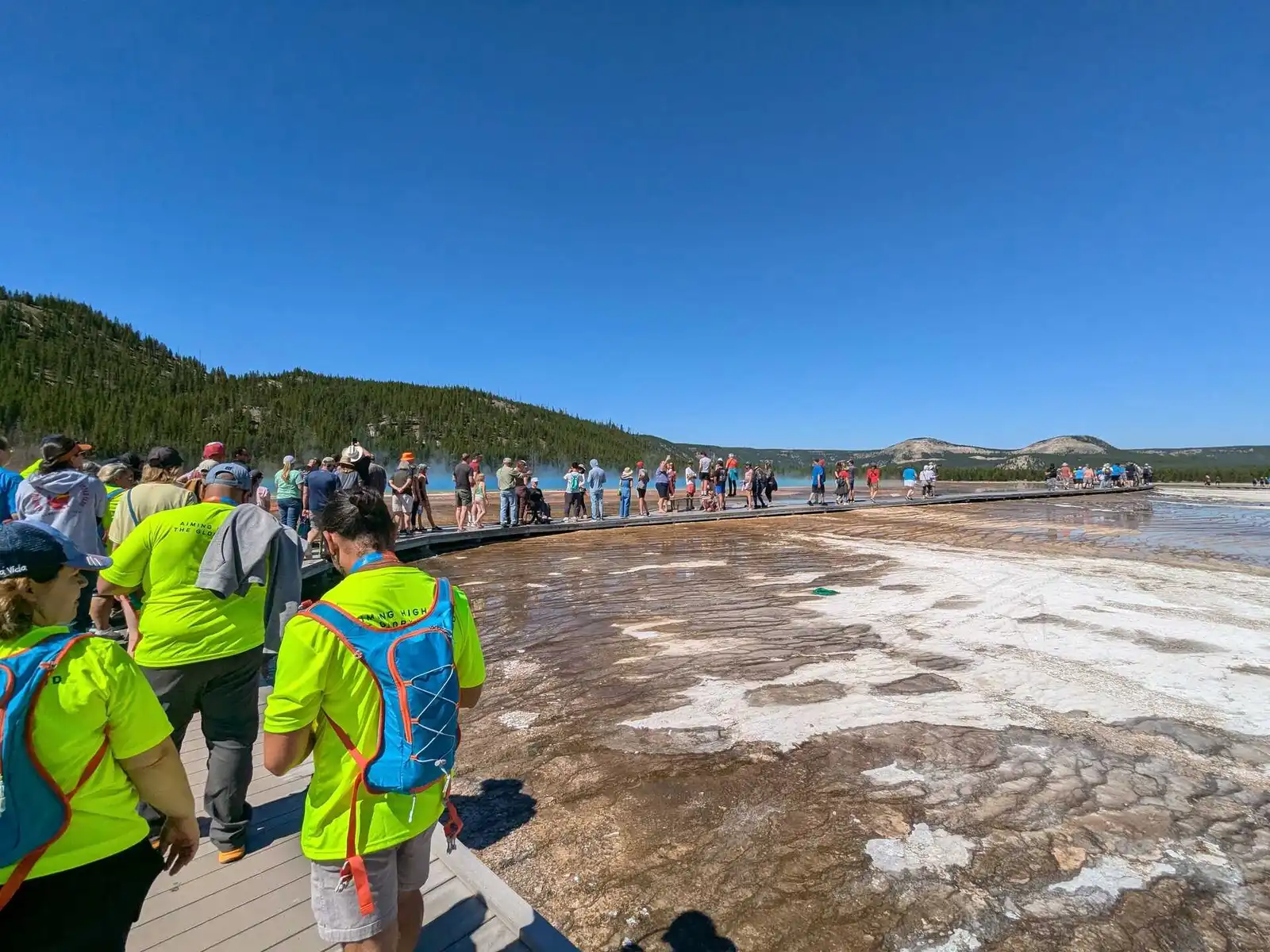
We continued on to Grand Prismatic Spring, one of the most popular spots in the park. Be prepared for parking problems here. There was no room in the main parking lot, but luckily we found a place to park a few hundred yards away, on the side of the road along the river.
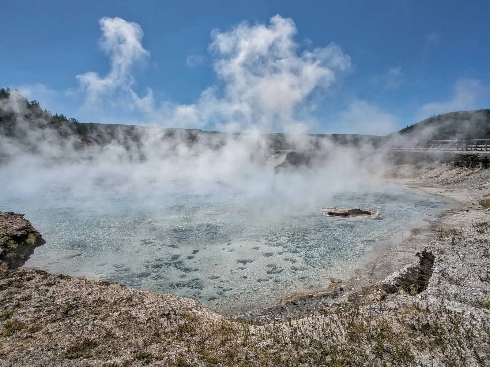
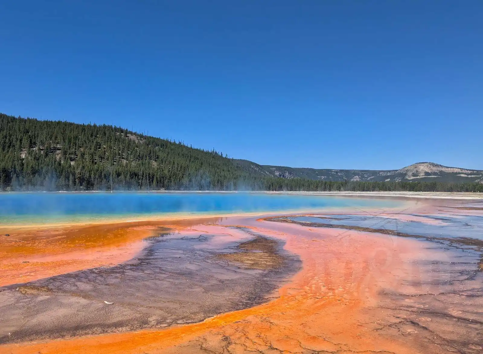
We walked back to the bridge by the parking lot and crossed the footbridges to reach first Excelsior Geyser Crater, a pool of hot water that is always shrouded in mist. A little further on we came to the Grand Prismatic itself. This is a truly spectacular sight - a body of water in many shades of blue and green, surrounded by yellow-orange-red banks. I’ve never seen such a beautiful lake before. It looks great in photos and even on satellite maps (which I consulted while writing this article). The only downside is that it is very popular, so there are literally crowds of people on the footbridges. Everyone is taking pictures and often getting in each other’s way.
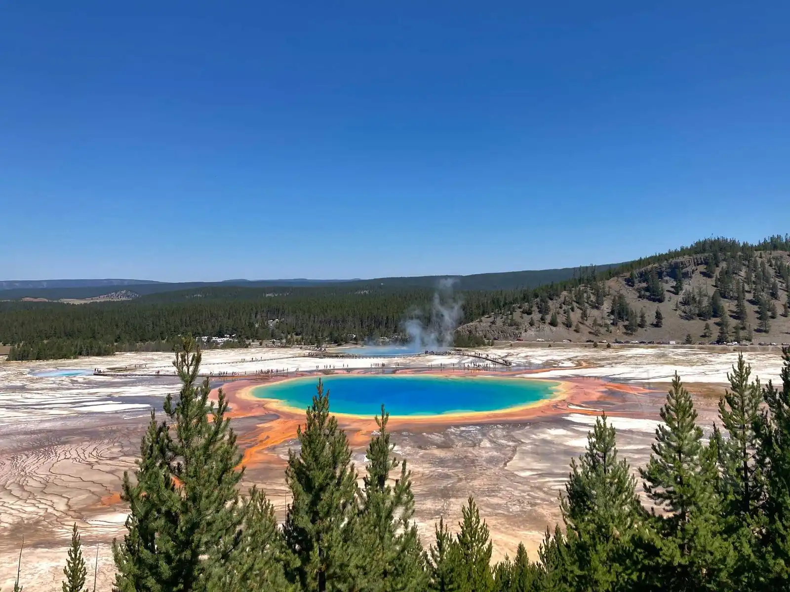
Just passing by the Grand Prismatic was not enough for us, we wanted to see the view of it as well. We drove a little further and walked about one mile to the Grand Prismatic Overlook. The view from afar was perhaps even nicer than up close, and there were a few less people there - many people didn’t want to walk this far and uphill.
After visiting Grand Prismatic, we had originally planned to stop at Biscuit Basin. Unfortunately, on the day of our departure from Prague there was a steam explosion in one of the geysers. Fortunately, no one was hurt, but the footbridges were damaged and the area and parking lot remained closed for the rest of the 2024 season.
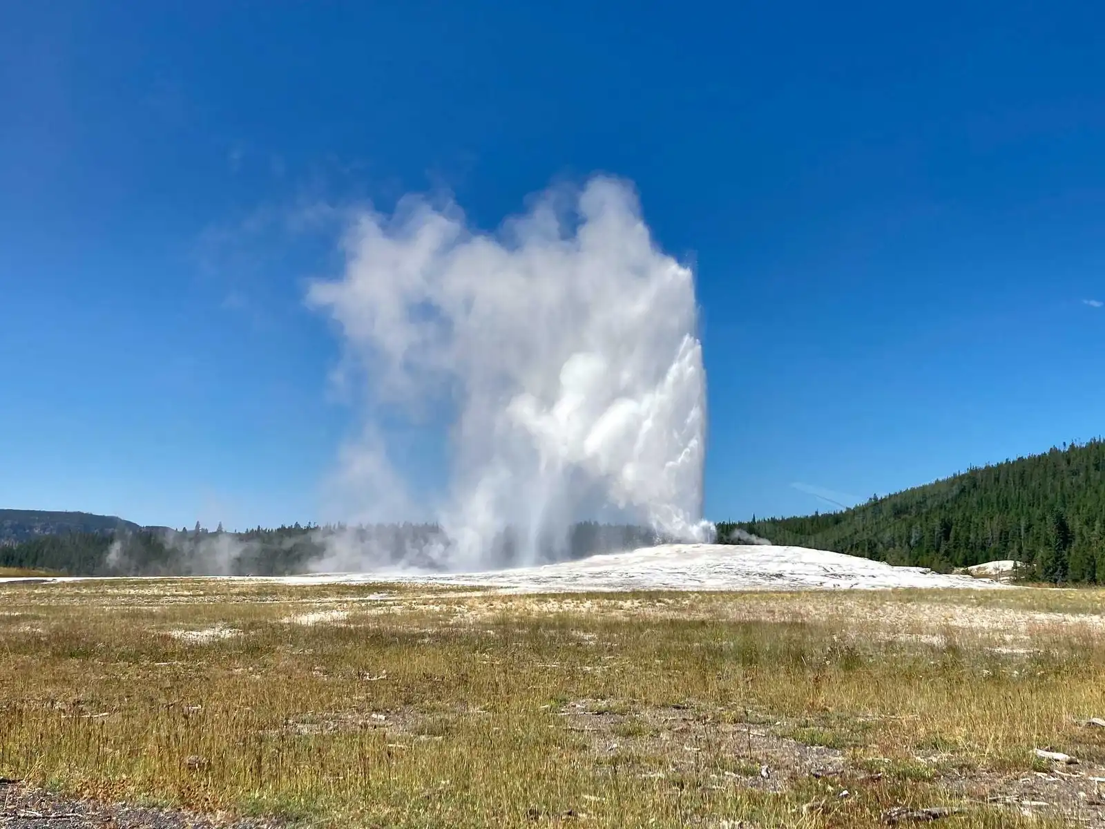
Instead, we drove straight to Old Faithful. This famous geyser, which competes with Grand Prismatic for the title of most popular spot in the park, is known for its regular eruptions that draw crowds. Luckily, they have a huge parking lot here, so at least that’s not a problem. Old Faithful earned its popularity perhaps because of its regular eruptions every 90 minutes or so, which are very predictable. You can find an estimate of the time of the next show in the parking lot and on the website. We had plenty of time, so we bought ice cream at the parking lot (one scoop for $6, two for $7 - we took two and shared). We then slowly made our way to the geyser and arrived there just in time for the next eruption. We saw one of the smaller ones, but it was still fascinating to watch the huge mass of water shoot up tens of metres. At the end, people were clapping. Based on our experience in Cheyenne, we’re guessing that if the prediction was exact, they would have sounded the national anthem at the beginning.
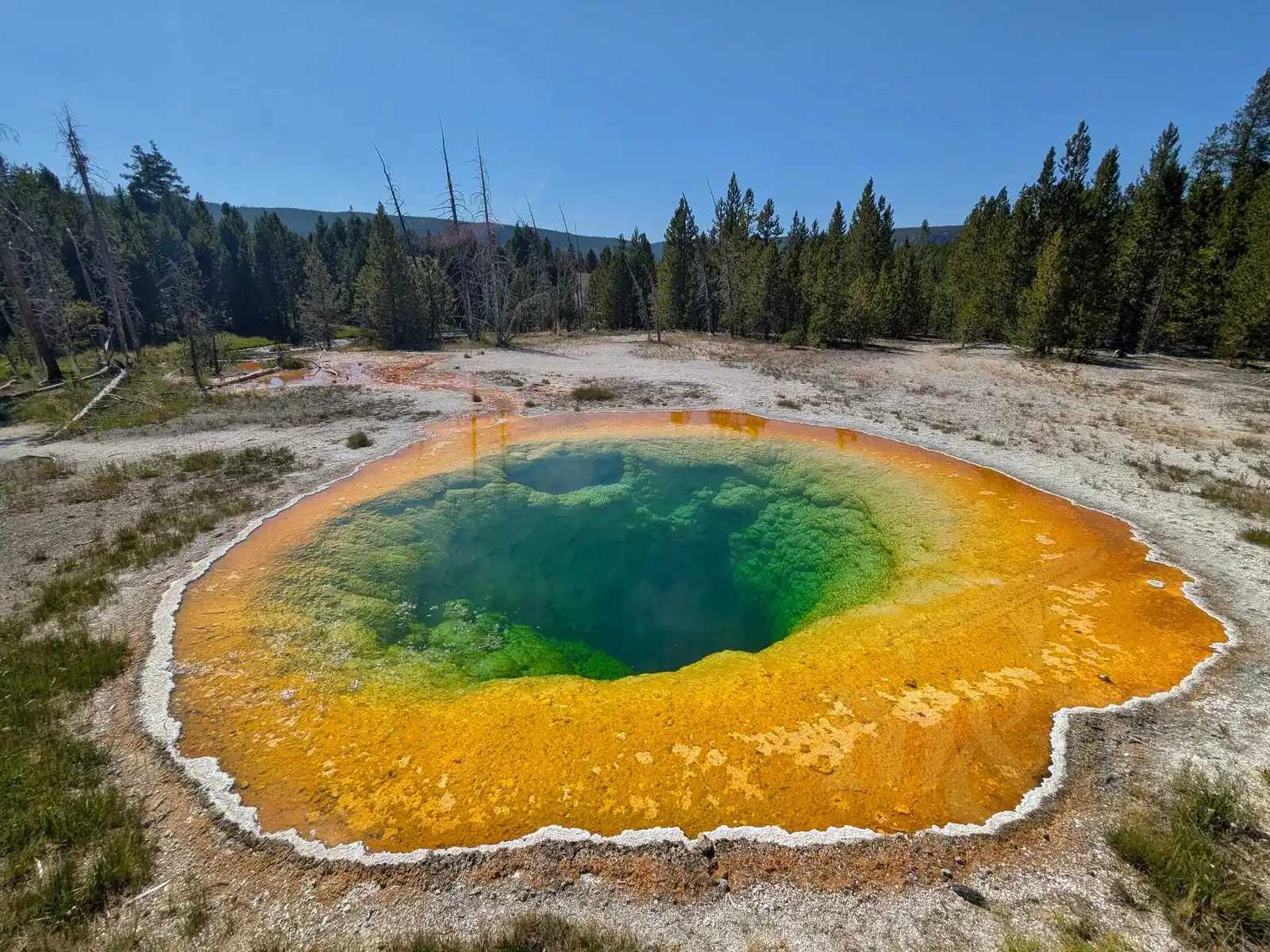
Old Faithful is just one geyser, but there are many other thermal pools and geysers in the area, such as Ear Spring, Chromatic Pool, Grotto Geyser, and others. Each one is beautiful and completely different. From a distance we could see Castle Geyser, which was just spouting - also a breathtaking sight. We made it as far as Morning Glory Pool, which was definitely worth it. It’s a beautifully coloured pool, actually a bit like a smaller Grand Prismatic, but with far fewer people.
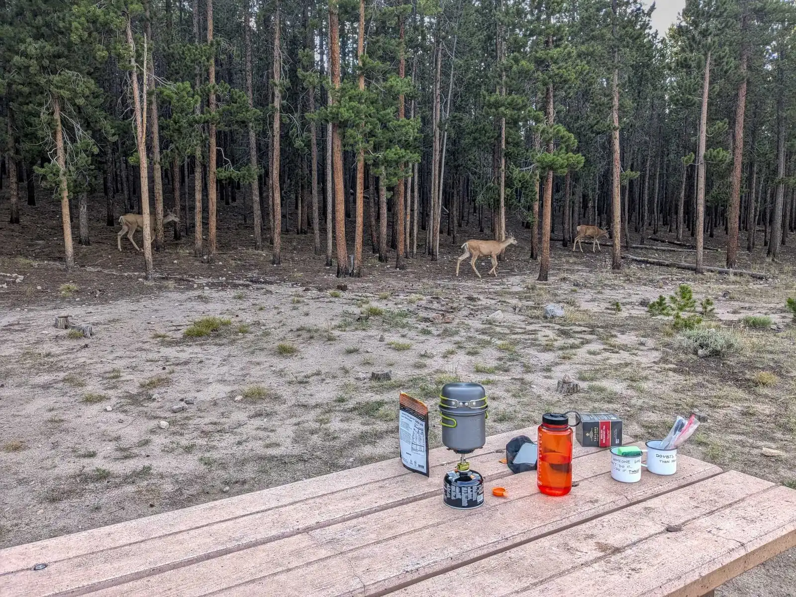
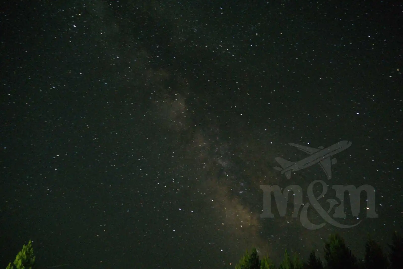
After a busy day, we had enough, so we got in the car and headed to Bridge Bay campground, where we spent our last night in Yellowstone. We set up our tent and decided to walk to Yellowstone Lake in the twilight. On the way back, we met some wapiti deer in the meadow, who came within a few meters of the humans (who, despite all the warnings, of course tried to get as close as possible). I managed to take some beautiful photos of the starry sky before going to bed.
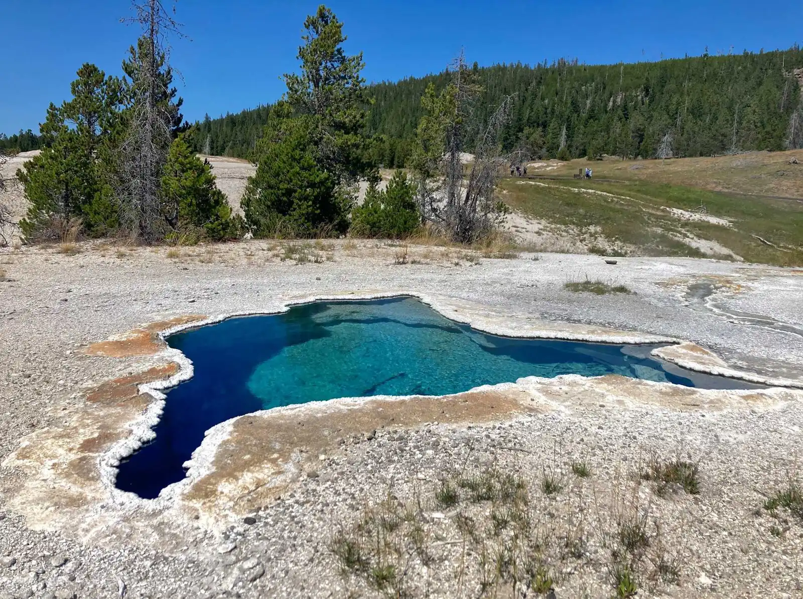
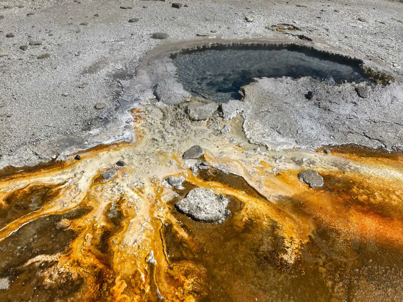
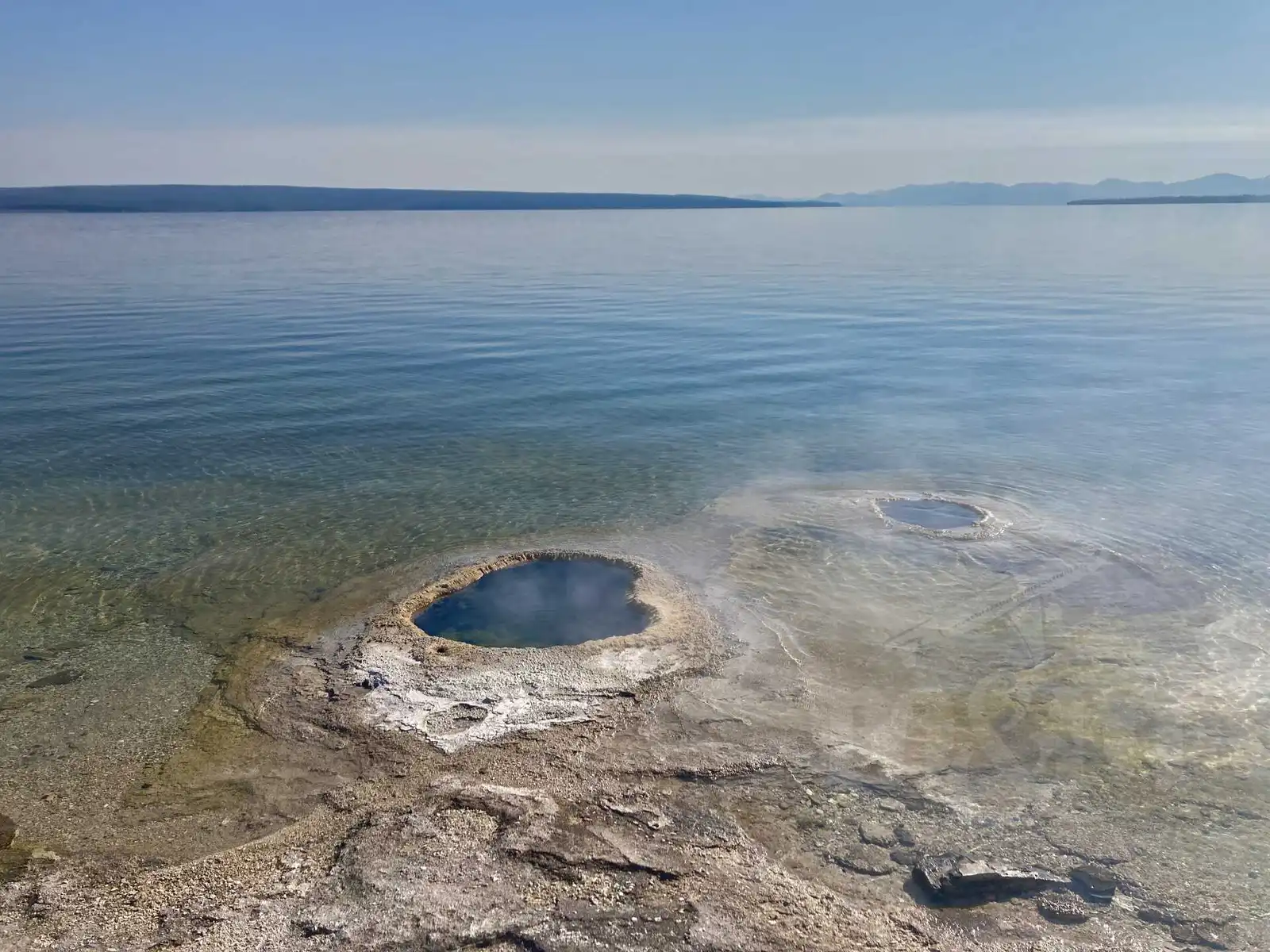
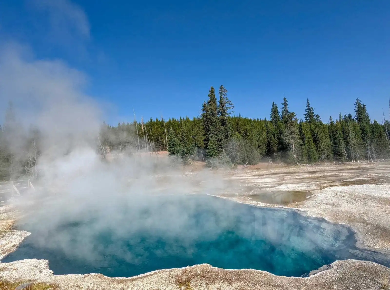
In the morning we were going to leave Yellowstone by the southern exit. But before that we made one last stop at the geysers at West Thumb. We were most impressed with the geysers and bubbling pools on the edge of Yellowstone Lake, as well as two beautiful boiling pools, Black Pool and Abyss Pool.
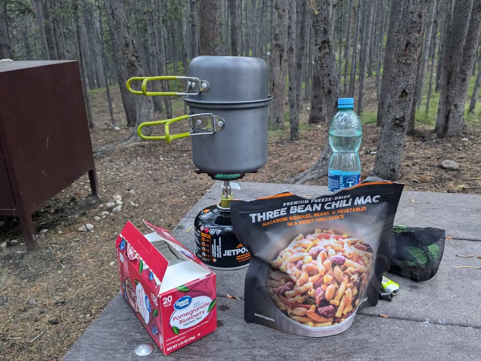
After this last stop, we left Yellowstone. We passed the Continental Divide again on the road, we crossed this imaginary boundary several times on our trip. Overall, we were most impressed with the western part of Yellowstone - Mammoth Hot Springs, Norris, Grand Prismatic and Old Faithful. If we had less time, we would definitely focus on these places. We used the food we brought and cooked the whole time in Yellowstone (well, just boiled water to pour over dehydrated food), but there are restaurants in Canyon Village, Mammoth Hot Springs, and Old Faithful.
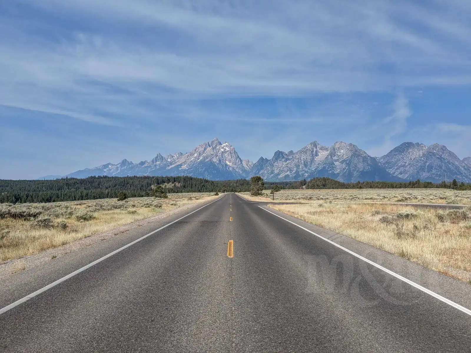
Grand Teton
After less than an hour’s drive from Yellowstone National Park, we arrived at another national park - Grand Teton, named after the Grand Teton mountain. The road in the park first goes along the eastern side of Jackson Lake. Across the lake, you can see spectacular views of the majestic mountains. Our first stop was Colter Bay, where there is an information center and gift shop. We had lunch at a table on the shore of the lake and enjoyed the views of the mountains across the lake.
We then decided to walk a few miles of the Lakeshore Trail, which leads from the visitor center to a nearby wooded peninsula. When we arrived at the peninsula, we met a Swiss woman who warned us that she had seen a bear cub in the woods, and apparently the bear was not far away. This immediately discouraged us from continuing our journey. I did have bear-spray with me, but I only knew its use in theory. It was only here that the Swiss woman explained to us how to use it properly. Fortunately, we hadn’t met the bear before. On the way back to the car, Magda banged two sticks against each other to scare away all the bears in the area.
Since it was hot, we decided to go swimming at String Lake. Unfortunately, this lake is very popular in the hot summer, which meant it was virtually impossible to park. We circled the parking lot several times, but couldn’t find a spot. Locals often bring their kayaks and other watercraft here, and no one wants to leave the water on a hot day. Magda at least made her way around the lake (which she considers a heroic act) and took a few photos while I circled the parking lot.
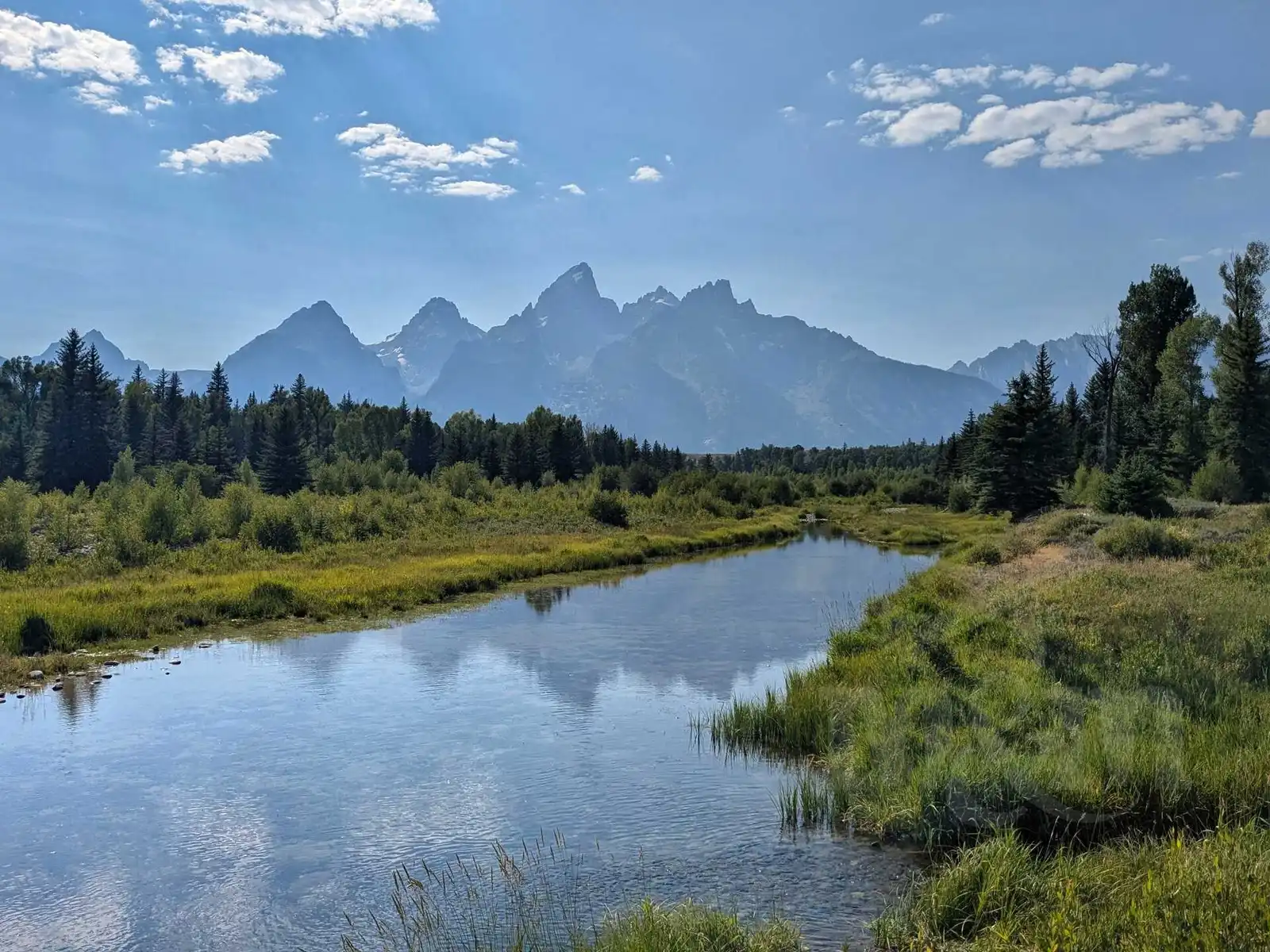
After we failed to park at String Lake, we headed to Jenny Lake next to it. Parking was problematic there too, but we eventually found a spot. We took our swimsuits out of the car and walked to the water. The lake was beautiful and very refreshing in the heat. After swimming, we visited two viewpoints. The first was Schwabacher Landing, where an unpaved road leads. We were a little worried to drive there with our beautiful car, but it was fine in the end. The mountains in the distance mirrored in the creek beautifully. The second viewpoint was the Snake River Overlook, where the famous Ansel Adams photo that is now shown in photography classes was taken. Since 1942, however, the site has become overgrown, so nothing like the original shot can be taken. Still, it’s a nice spot.
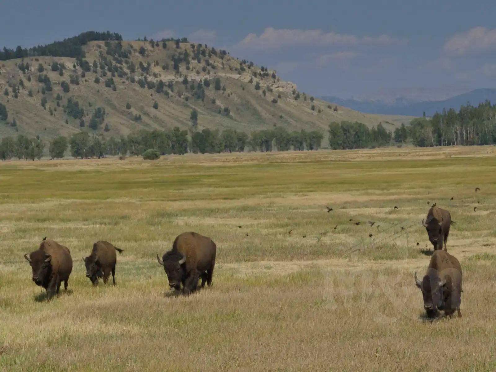
On the way to Lizard Creek campground we again encountered bison, which crossed in front of our car without hesitation. Lizard Creek campground was much smaller and simpler than the Yellowstone campgrounds, but offered a beautiful view of the lake. There we cooked and ate dinner as the sun set.
After waking up and packing our gear, we hit the road the next morning. The campground where we stayed was fine, but its location was not ideal. It’s in the north of the park, while most of the attractions are more to the south, around Jenny Lake, so we were in for a longer drive.
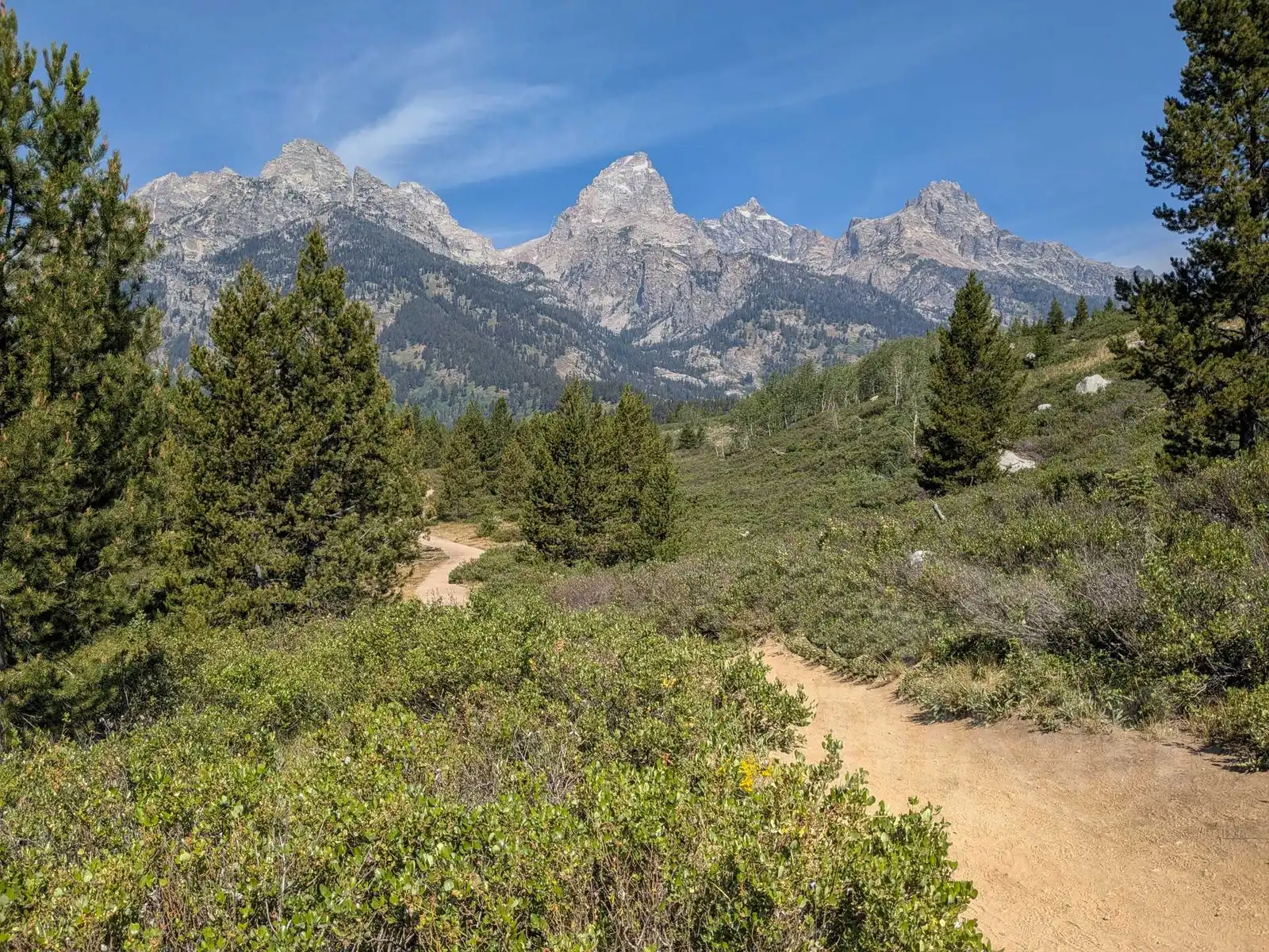
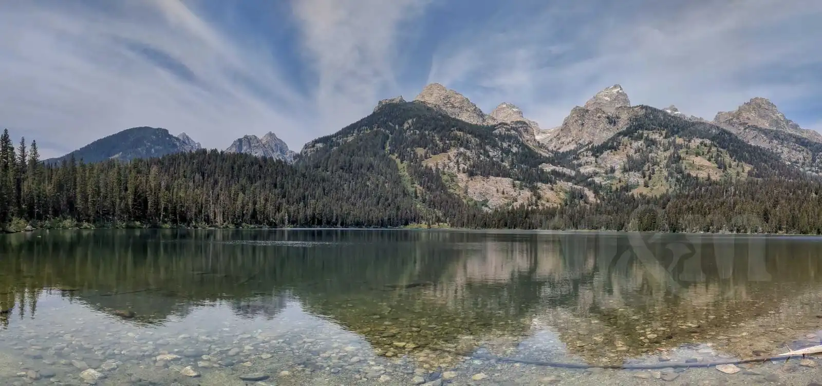
Our first goal of the day was to hike to Taggart Lake and maybe further to Bradley Lake. The parking lot at the Taggart Lake Trailhead was almost full, so cars were parked on the side of the road, but no one minded. The trail was through beautiful countryside. At Taggart Lake we cooled our feet in the lake. We still had plenty of energy, so we continued on to Bradley Lake. Both lakes, with the reflections of the mountains on their surfaces, were really beautiful.
We met an American family on the shore who wanted to know where we were from. When we told them we were from the Czech Republic, they asked how big a country it actually is compared to the USA. We replied that it is about one third of Wyoming, but about 15 times more people live there.
Taggart Lake and Bradley Lake was a nice walk for a couple of hours. After that, we left Grand Teton Park. We still drove the Moose-Wilson Road scenic drive, hoping to see moose - unfortunately we had no luck. We stopped in Jackson to see the antler gates on the square, and then continued on to Pinedale where we had a motel reservation. On the way to Pinedale, the surrounding landscape is changing dramatically, with the coniferous forests disappearing, the weather warming up, and the landscape becoming arid desert once again.
Pinedale is a small town in the middle of nowhere. But the sign on the map describes it as “All the civilisation you need”. There’s a gas station, a couple of restaurants and one supermarket that sells both food and guns. But after five days in the tent we appreciated this “civilization”. We took a shower, washed our dirty clothes and were glad to have a break from food preparation - we went to a burger stand.
Flaming Gorge
The road out of Pinedale is again largely empty, with the occasional roadside building, but otherwise just miles of desolation outside the windows. The only major town on the road is Rock Springs, where we had a fast food meal. We skirted the Flaming Gorge Reservoir on the west side. There was a thunderstorm over the southern part of the reservoir in the hills. We rather stopped for a while at a gas station in the village of Manilla (already in Utah) to wait for it to pass. We ended up skipping the originally planned Sheep Creek Overlook because we wouldn’t have gotten much out of it in the rain anyway.
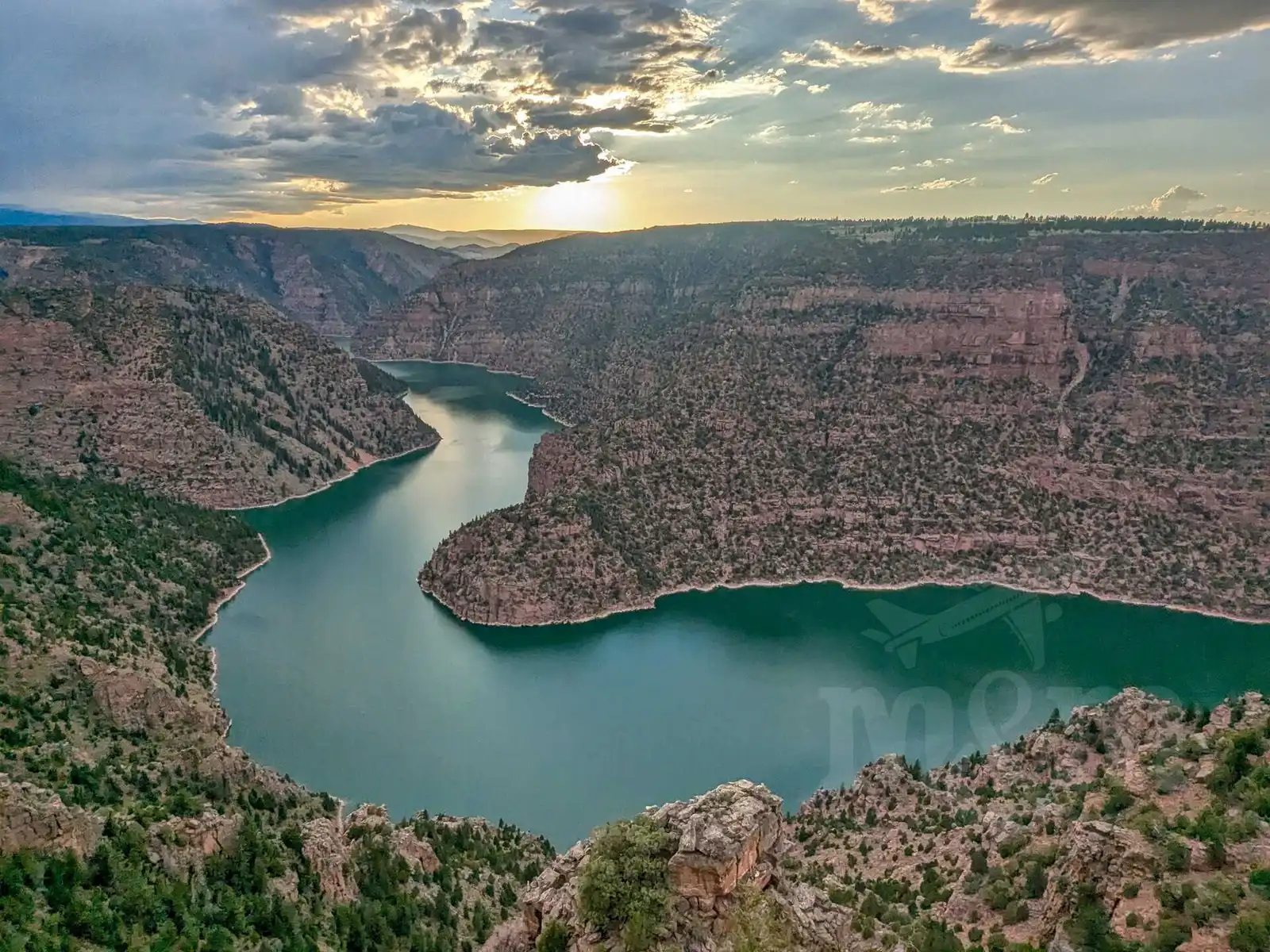
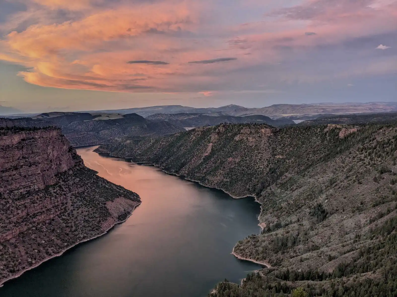
When the storm passed, we continued directly to our reserved campsite, Canyon Rim Campground. The drive through the hilly countryside offered some great views of the reservoir. Right next to the campground is a lookout for Red Canyon. It is very photogenic. We took a lot of breathtaking pictures at sunset. We had our tent set up a few dozen meters from the edge of the cliff, so we even forced ourselves to get up for sunrise (and after a few photos went back to sleep). It was a really beautiful spot.
The next day, after waking up long after sunrise, we visited the Red Canyon Visitor Center. And then - because it was hot - we went for a swim. Although the reservoir is quite large, it surprisingly has few places suitable for swimming. One of them is Sunny Cove, where we headed. It’s a small place with a parking lot and no facilities. The water was refreshing, but otherwise it’s not any spectacular place.
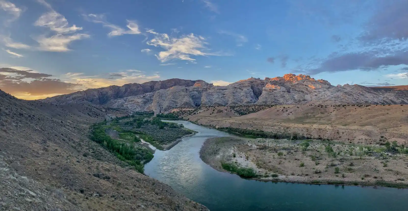
Dinosaur National Monument
Dinosaur National Monument is a place where the remains of many species of dinosaurs have been found. It lies on the border of Utah and Colorado in the Green River Canyon, about an hour and a half drive from Flaming Gorge (which is a dam on Green river). We only visited a small part of it, the Quarry Visitor Hall and the petroglyphs behind it, which can still be reached by a paved road. We’ve read that there are possibly more beautiful places to see in the other part, which is already in Colorado, such as the amazing looking Steamboat Rock in the photos and all the views on the way to it. But we didn’t get there, that road is unpaved and only suitable for proper off-road vehicles. If anyone had more time, money and courage, you can also raft the Green River from Flaming Gorge to here in a few days.
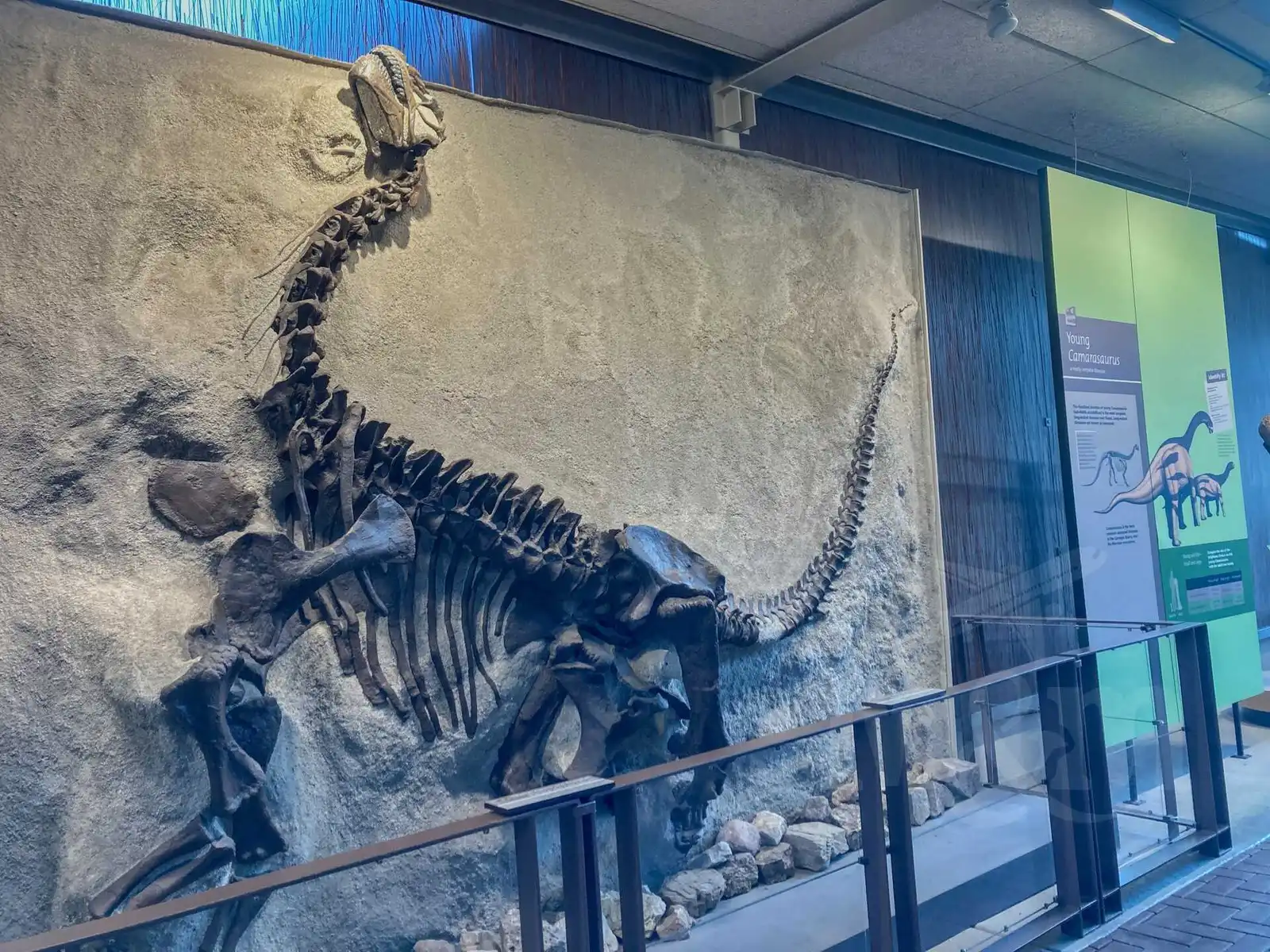
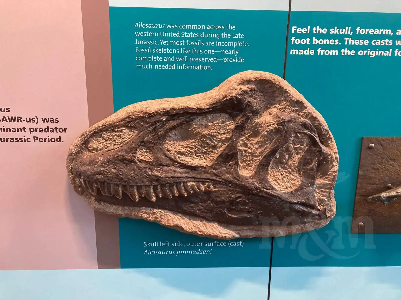
We started our tour at the Quarry Visitor Center, where we caught the last bus to the Quarry Exhibit Hall. The Quarry Exhibit Hall is a building surrounding an exposed rock wall with hundreds of exposed dinosaur bones. A river of dinosaur bodies has gradually washed into several areas, above one of which Quarry Exhibit Hall now stands. You can touch dinosaur bones, some bigger than ourselves. We’ve never been this close to dinosaurs before.
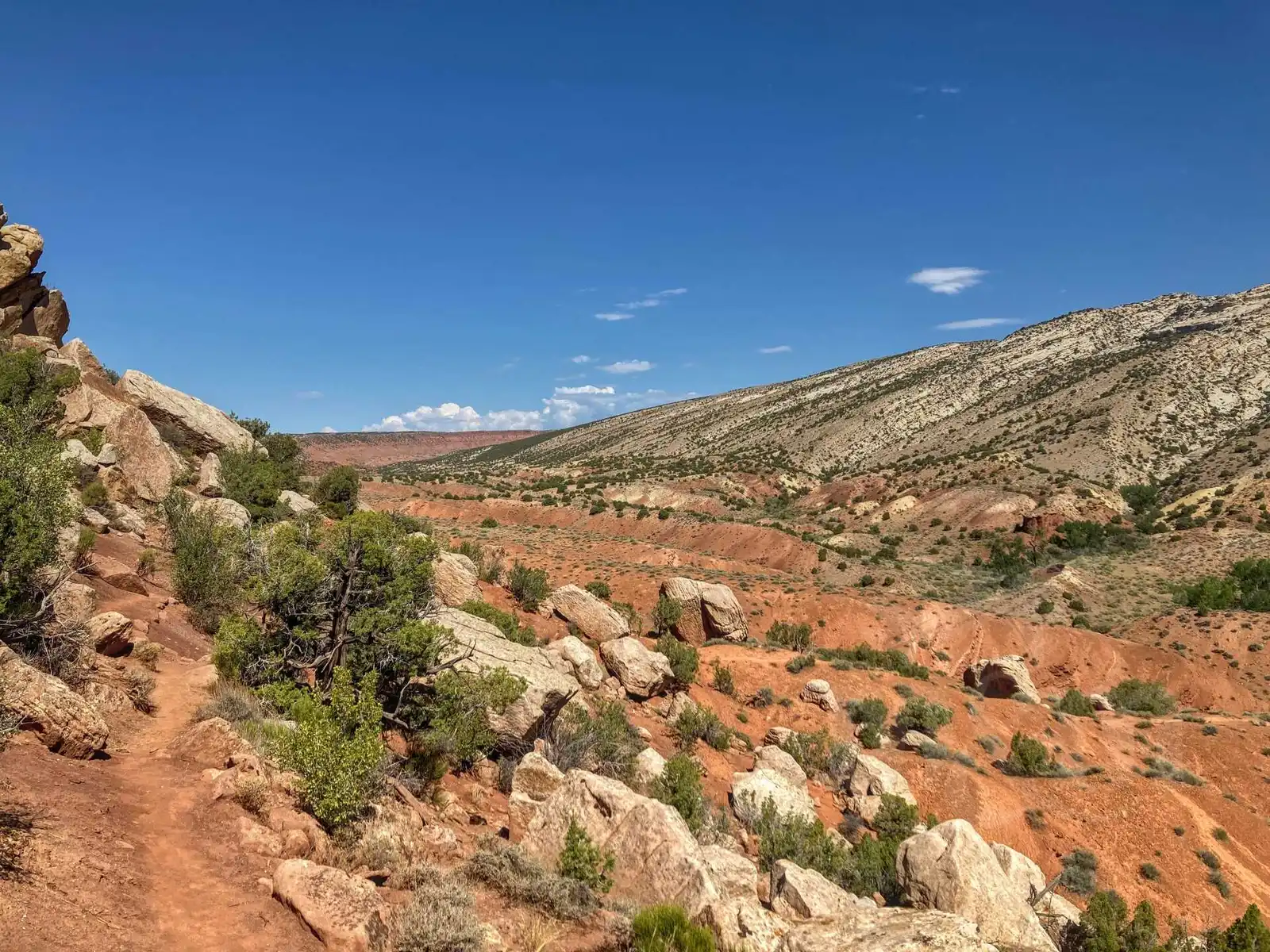
We walked back from Exhibit Hall to the parking lot along the Fossil Discovery Trail. Unfortunately, we didn’t see many fossils, but we had a plenty of the heat - even though it was early evening, it was the desert and the rocks absorbing the heat from the sun all day. The walk to the car park was less than two kilometres, but by forgetting our water, it gave us quite a hard time.
When we reached the car, we drove a short distance to Green River Campground, where we slept. It’s kind of an oasis in the middle of the desert, on the banks of the river. Next to us was a group of Americans who had come from Flaming Gorge on rafts. The camp was very nice. We finally didn’t have to worry about bears in the desert. When it got a little cooler in the evening, we went for a walk along the path downstream from the campground. The sunset there was beautiful.
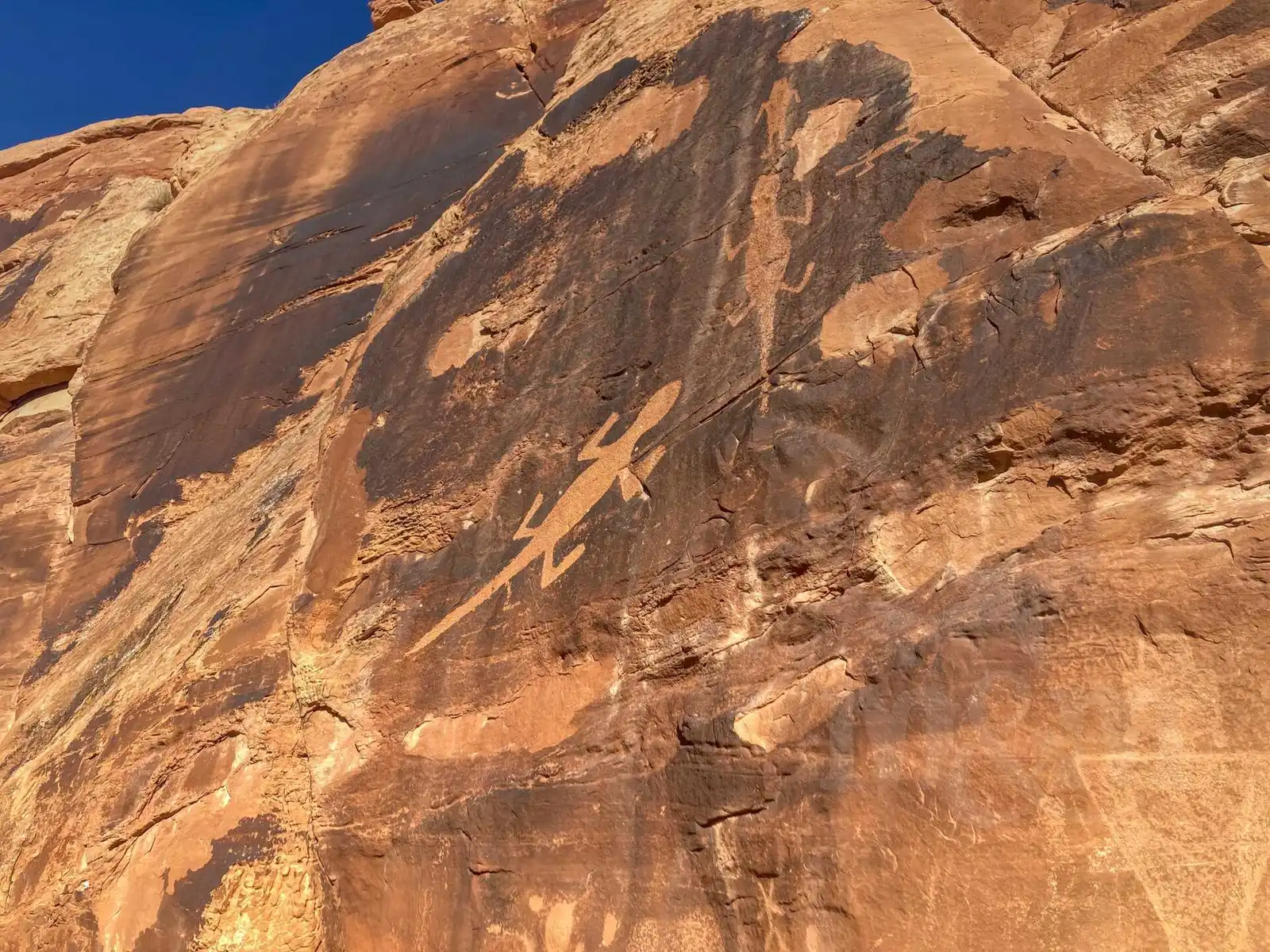
The next day we went a little further to the petroglyphs (rock paintings), remnants of the Fremont culture that inhabited Utah before Columbus. The most famous of these is a distinct painting of a lizard, located just a few dozen yards from the road. We drove to the end of the paved road to Box Canyon and Hog Canyon, and then turned back. We hiked about five kilometers of the Sound of Silence trail, which wasn’t the best idea before noon in the desert, but it was doable (luckily we brought water this time). The name is fitting, silence is really all you hear there.
We drove out of Dinosaur National Monument (we still took a picture of the sign and a rather ugly plastic dinosaur at the entrance) and continued to Colorado. At the first village called Dinosaur (Americans really don’t spend much time coming up with creative names) we turned off the main road and drove to Grand Junction. On the outskirts of town, we stopped at REI and bought some supplies. It was really hot, getting out of the air-conditioned car was quite a shock. We were looking for a pool, unfortunately we couldn’t find anything good in town. Not even an ice cream stand. So we finally stopped at the Safeway mall on the edge of town (even crossing the hot parking lot was an experience), bought a whole cup (16oz - almost half a liter) of Ben & Jerry’s ice cream and ate it all in the car with the air conditioning on.
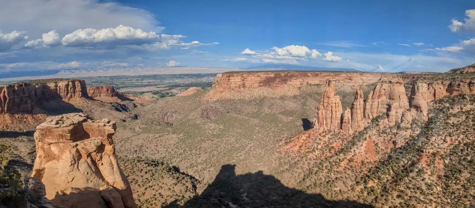
Colorado National Monument
We continued into the hills above Grand Junction, where the Colorado National Monument is located. It was the last park where we could use the America the Beautiful card. Unfortunately, there was no one at the booth at the entrance to check the card and give us a map, which was a little disappointing.
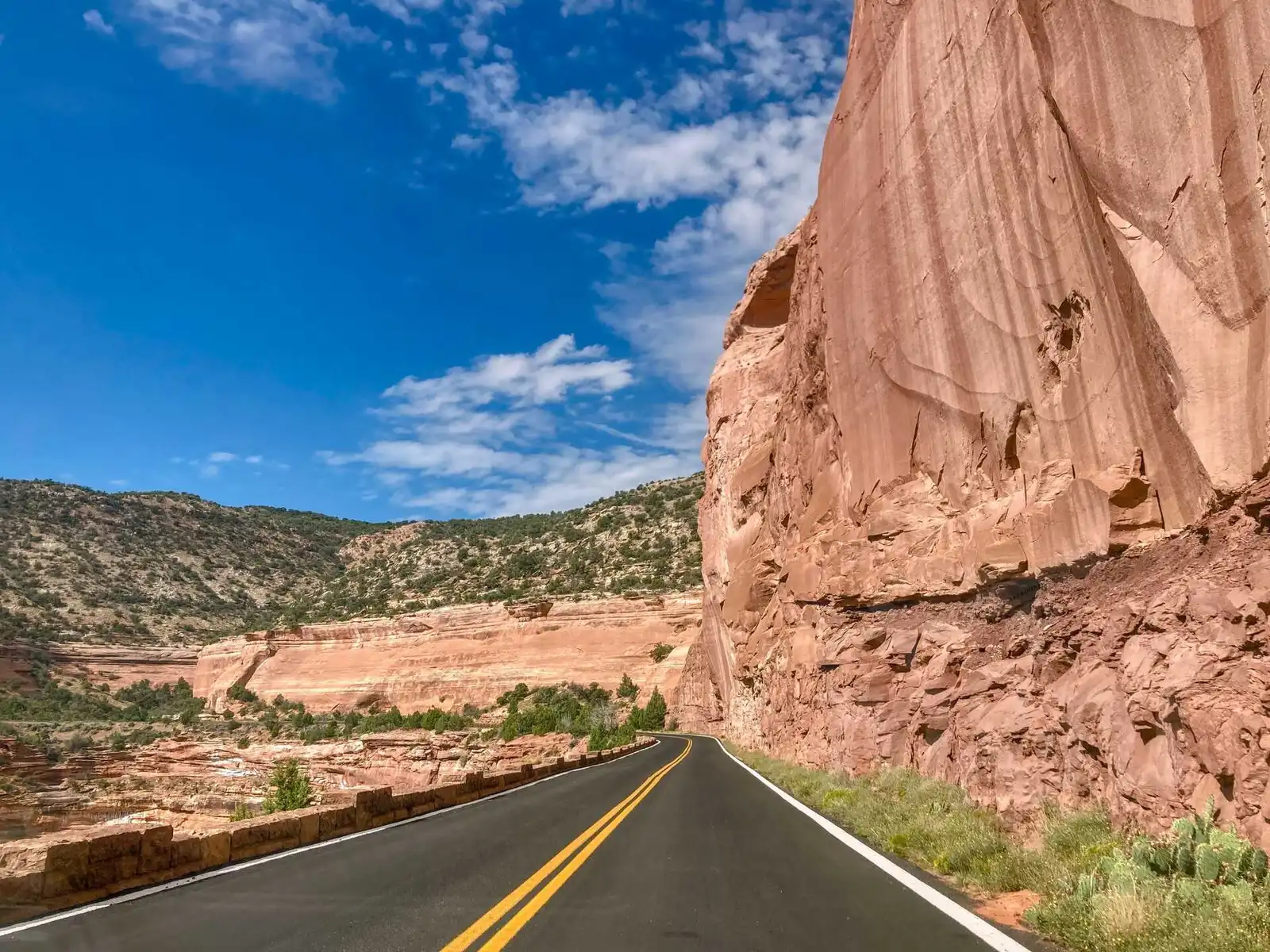
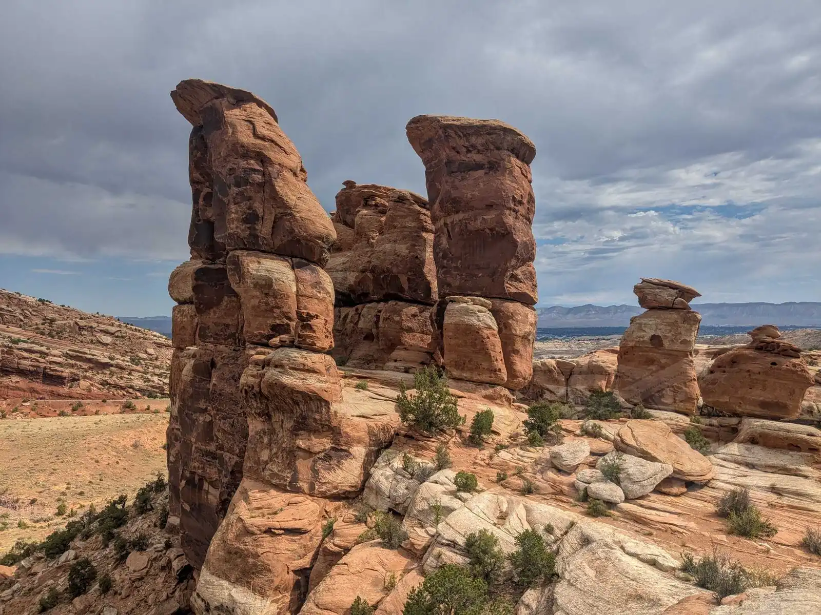
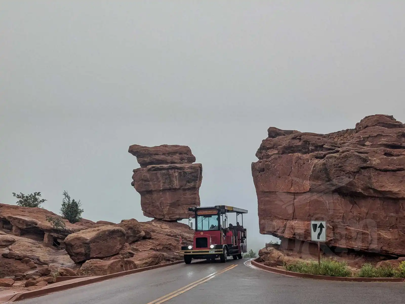
Colorado National Monument is basically canyons and huge, several hundred foot rock formations. The rocks are red, as they should be in Colorado. It’s a bit reminiscent of Zion National Park in Utah, a few hours drive away, which we unfortunately didn’t see (we would have suffered in the heat there, too). The park is pretty small, basically only one road (Rim Rock Drive) with places to stop along it.
The road runs along the edge of the plateau most of the time and offers some great views of the rocks. Occasionally an overhang of rock extends above the road, and you just hope it won’t move. Due to the heat, we mostly just stopped for a while, checked out the area, snapped a few photos, and kept going. It’s beautiful, unfortunately it’s difficult to take pictures in the afternoon because of the long shadows the rocks cast.
We made it to Saddlehorn Campground, where we stayed that night. When it cooled down a bit, we walked around the campground and enjoyed the view in all directions. Unfortunately, it didn’t cool down enough to get a good night’s sleep. While a few days ago we were almost freezing in Yellowstone with temperatures around zero, here it was around 30 degrees Celsius at night. We didn’t even take our sleeping bags out, we took most of our clothes off, but it was still not much of a sleep.
The next morning we still hiked the trail to Devil’s Kitchen. We saw some very nice rocks, but we’re not sure we made it to the end of the trail, the path isn’t very well marked and eventually disappears.
Glenwood Springs, Independence Pass, Aspen
We left Grand Junction and headed towards Glenwood Springs. Since it was still awfully hot, we were looking for a place to take a swim. We found a swimming hole along the way, in a town with a peaceful name Rifle (Rifle Metro Pool). We drove there and spent a couple of hours by the water and in the water (admission is $10/person). Compared to Czech pools, we were surprised by how many lifeguards were constantly patrolling the pools. And they whistled at anyone who acted even the slightest bit dangerously.
Swimming was interrupted by a thunderstorm that caused the pools to close. Fortunately, it also cooled the air a bit. We got back in the car and drove to Glenwood Springs. There are several thermal pools there, but all quite expensive for a short visit. We had scouted out a thermal pond on the outskirts of town that was accessible for free (South Canyon Hot Springs), but we didn’t feel like swimming after the storm, so we went straight to the hotel. In the evening we explored downtown (and Two Rivers Park), where the Colorado River meets another river whose name is not important. The Colorado is a real river here, not the little creek we saw in Rocky Mountain. There was some sort of festival going on in the park where we sat for a while and had something to eat.
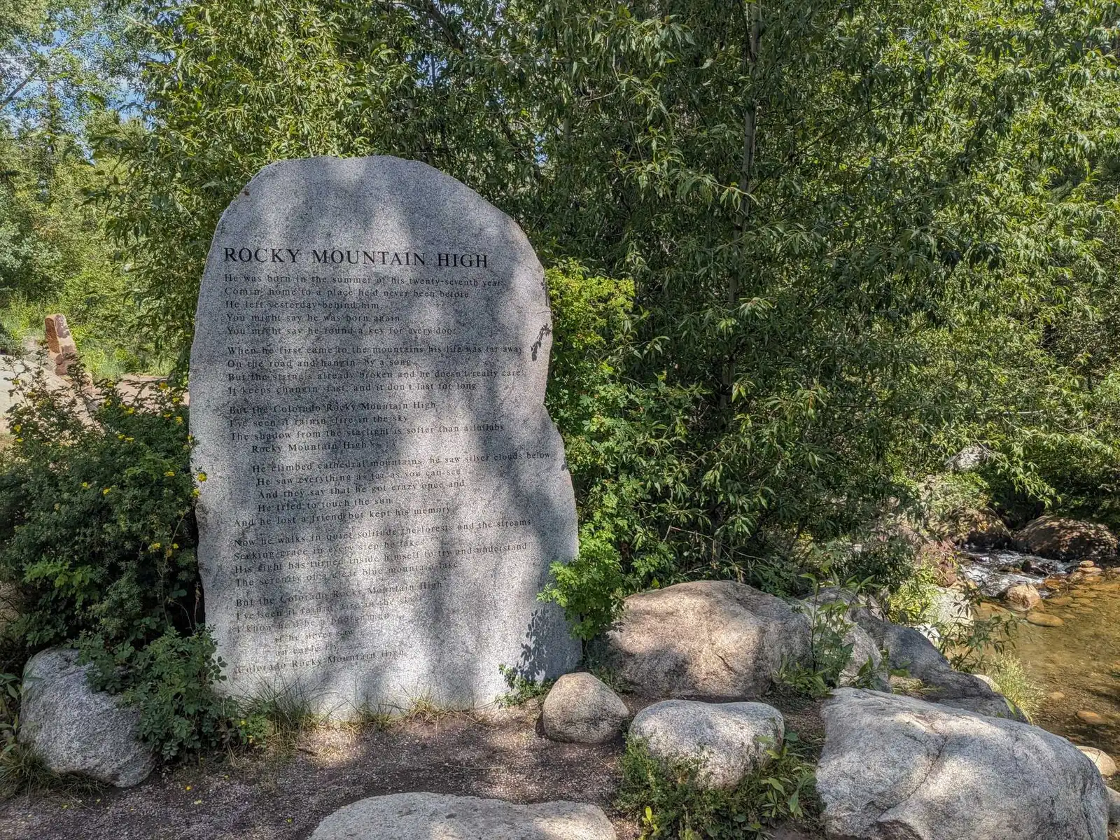
After a good night’s sleep, the next day we had a drive over the mountains to Colorado Springs. We stopped in Aspen. It’s a famous ski resort, but we didn’t come here in the summer to ski. We stopped downtown where there is a park and the John Denver sanctuary, with John Denver lyrics carved on the rocks. It’s a special place. Aspen, by the way, has a big parking problem, it was probably the only place during our entire trip across the US where we paid for parking ($2).
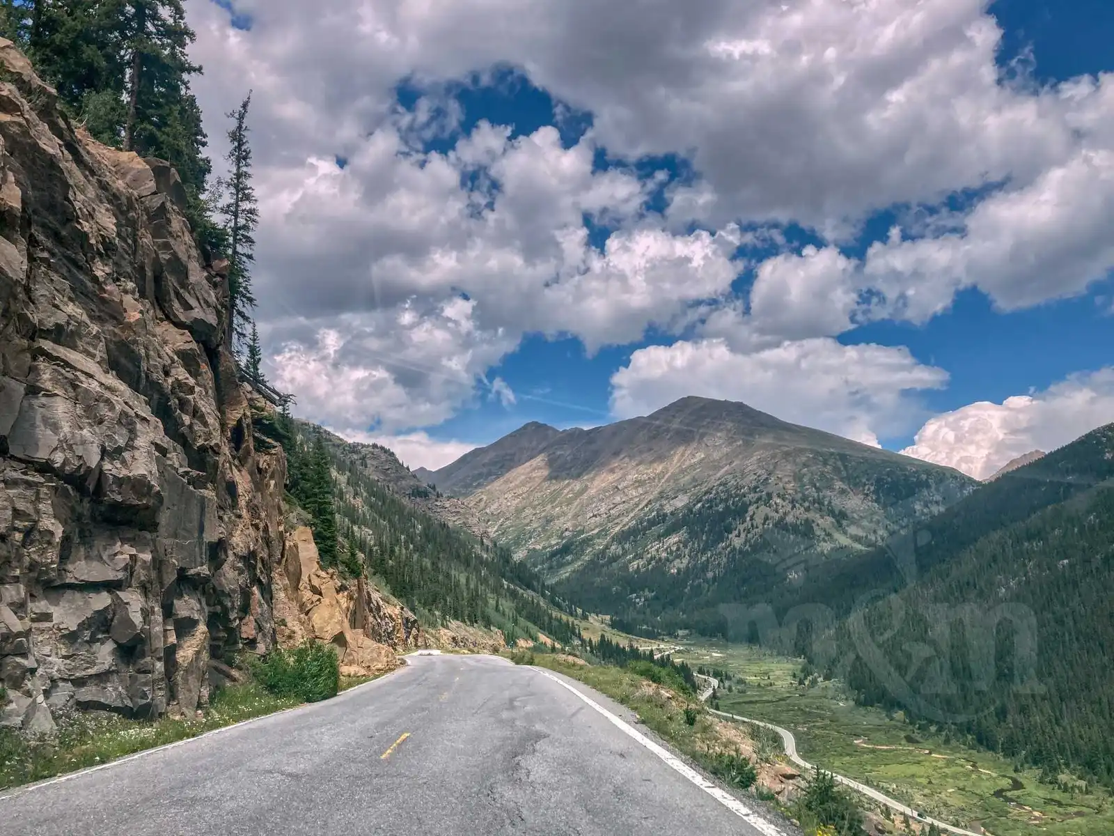
Behind Aspen, the famous Independence Pass begins. The road climbs up with many curves. You reach the mountain tops, at 12095 feet (3686 m) above sea level, where once again is our well-known Continental Divide. There’s a parking lot and you can walk a few hundred yards to the overlook. The overlook is nice, but you won’t be able to stand there for long, it’s pretty cold there too. After the Continetal Divide, the road drops down and in an hour you reach Twin Lakes, almost 1,000 metres down. The drive over Independence Pass is beautiful, the views in all directions are impressive.
We cooked a meal at a table by one of the lakes and ate. In the afternoon it clouded up and started to rain, so we didn’t stop much. Colorado Springs is more than a 2 hour drive from Twin Lakes, it didn’t go by too fast in the ugly weather. Somewhere in the middle of the trip I stopped at a gas station for coffee. I poured some from the big jugs they have there. When I searched for my wallet to pay, the attendant just waved it away. Saved me a dollar or two, but it’s a nice gesture.
Colorado Springs
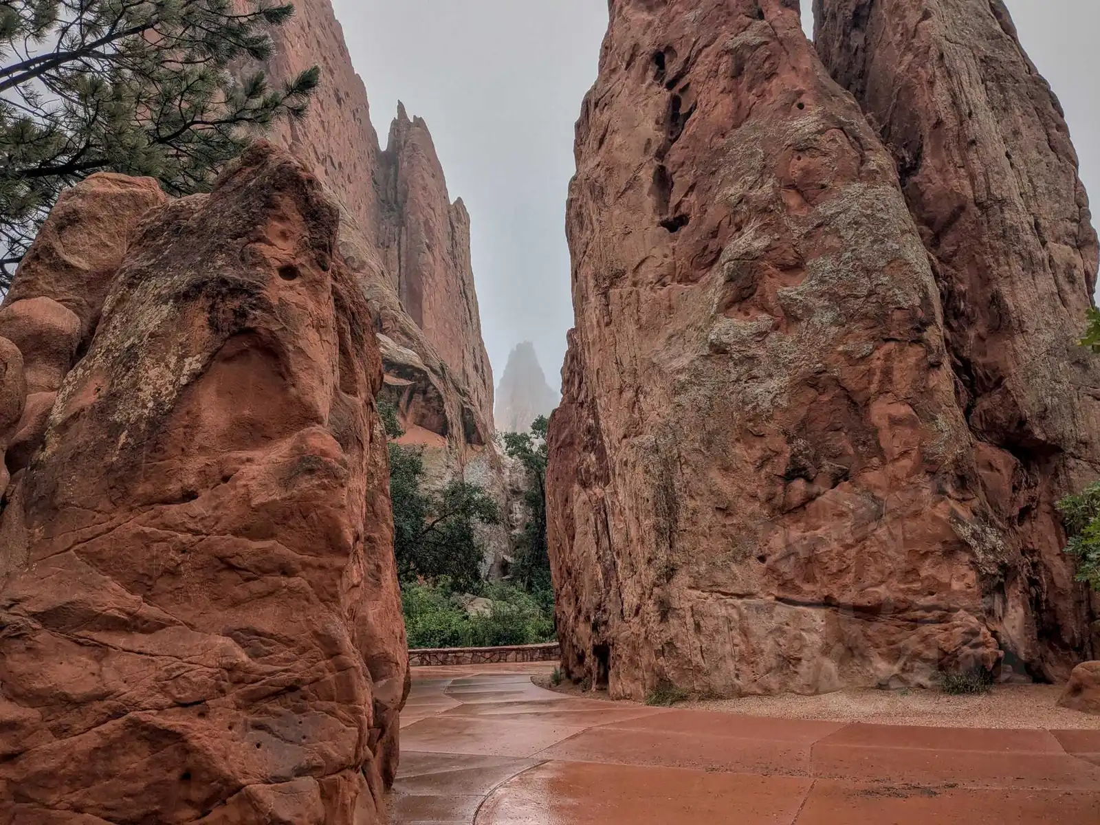
When we drove to Colorado Springs, we wanted to stop at the Garden of the Gods, on the edge of the city. It’s a preserve with strangely shaped large rocks. The weather wasn’t ideal, but we decided to walk at least a little bit and come back the next day. It’s a good thing we stopped there right away, the weather was even worse the next day - we walked it in raincoats and the views were non-existent.
We had booked an Airbnb in Colorado Springs, hosted by Alice, a retired teacher. It was probably the nicest accommodation we had ever stayed in, a whole floor of the house in the garden, beautifully decorated. The host even made us breakfast, which we weren’t expecting. And all for a very nice price of $80 per night.
As a fan of the Stargate series, I was a little disappointed that you couldn’t see anything of the Cheyenne Mountain Complex, the central location of the series, in Colorado Springs. Unfortunately, the huge bunker that used to be the headquarters of the North American Aerospace Defense Command is still an active military installation and can’t be seen even from afar, with the road to it closed off well before you enter (they take this very seriously in the US).
All we had to do was drive to Denver to return the car and spend our last day there.
Denver
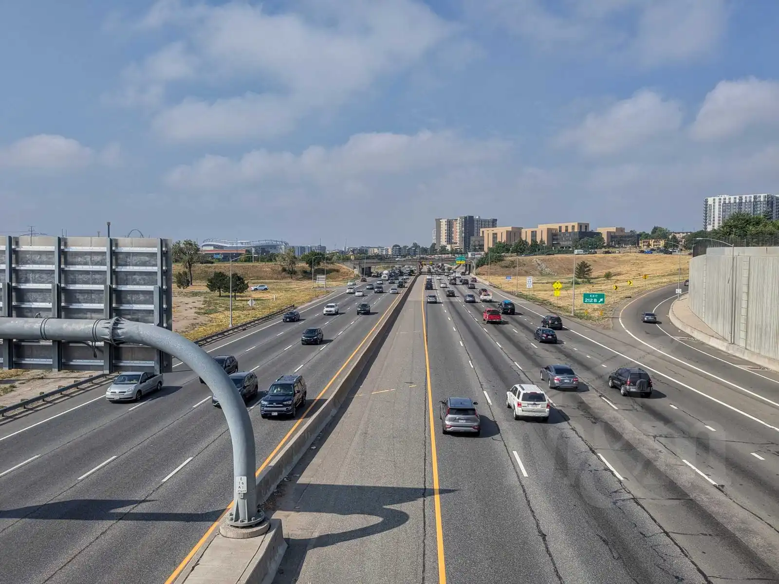
From Colorado Springs to Denver, I-25 is a highway with five or more lanes in one direction. You can overtake on the highway from both the left and the right in the US, so it was quite a stressful experience at times. Especially when you’re being overtaken by a truck whose wheels you can barely see out of the window. But you get used to it.
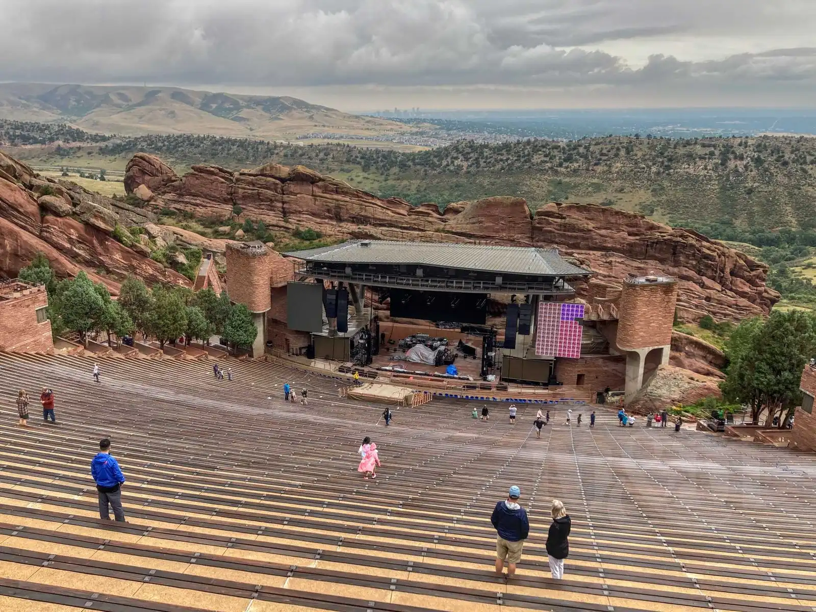
Before reaching downtown Denver, we got off the highway and drove to Red Rocks to see the park and the amphitheater. The amphitheater is probably the most famous concert venue in Colorado, surrounded by rocks and overlooking the city below. Probably all the big names in music have performed there, and there’s even a small museum and hall of fame where you can see photos and artist lists. We just wanted to check it out, we didn’t see any concerts there (there weren’t any that interested us in those days + tickets are very expensive - $200+). There are tourist shelters in the adjacent park where we boiled water for our last dehydrated lunch (and finished the second gas cartridge so we could puncture it and dump it in the dumpster).
Then we were off to downtown Denver, where we returned the car. We’ve driven exactly 2,219 miles since we rented it. From the rental place, we used the bus to go all the way downtown, to Union Station. Right next to it, we had reserved a luggage storage facility (LugDen, a van parked in front of the station) where we stored our luggage with our tent and sleeping bags for $10 until the next day when we flew out.
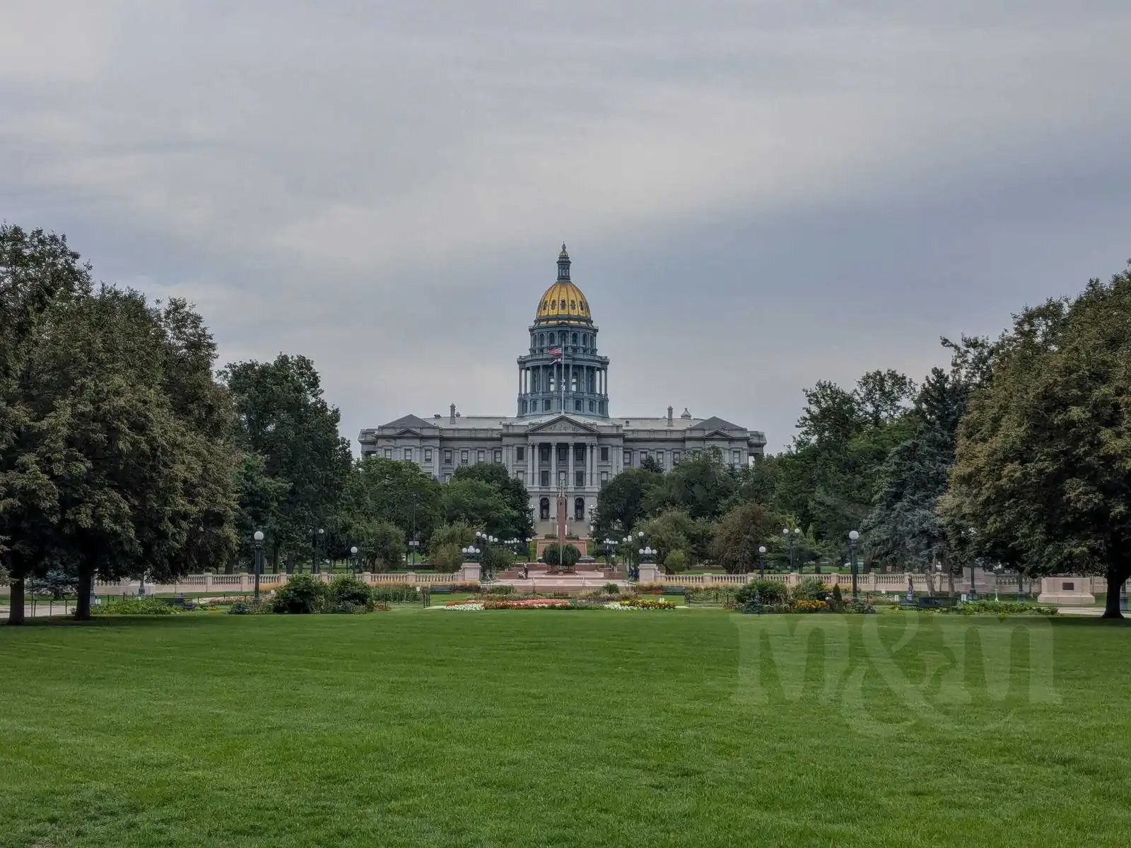
My friend from Boulder came to Denver to see us. We had a lot of time, so we walked all over downtown Denver with him. We looked at the state capitol and the park in front of it. We ended up having pizza at a restaurant called Mellow Mushroom. We didn’t want to go back to Boulder, so after dinner my friend and I said goodbye and we headed to the Airbnb we had booked there.
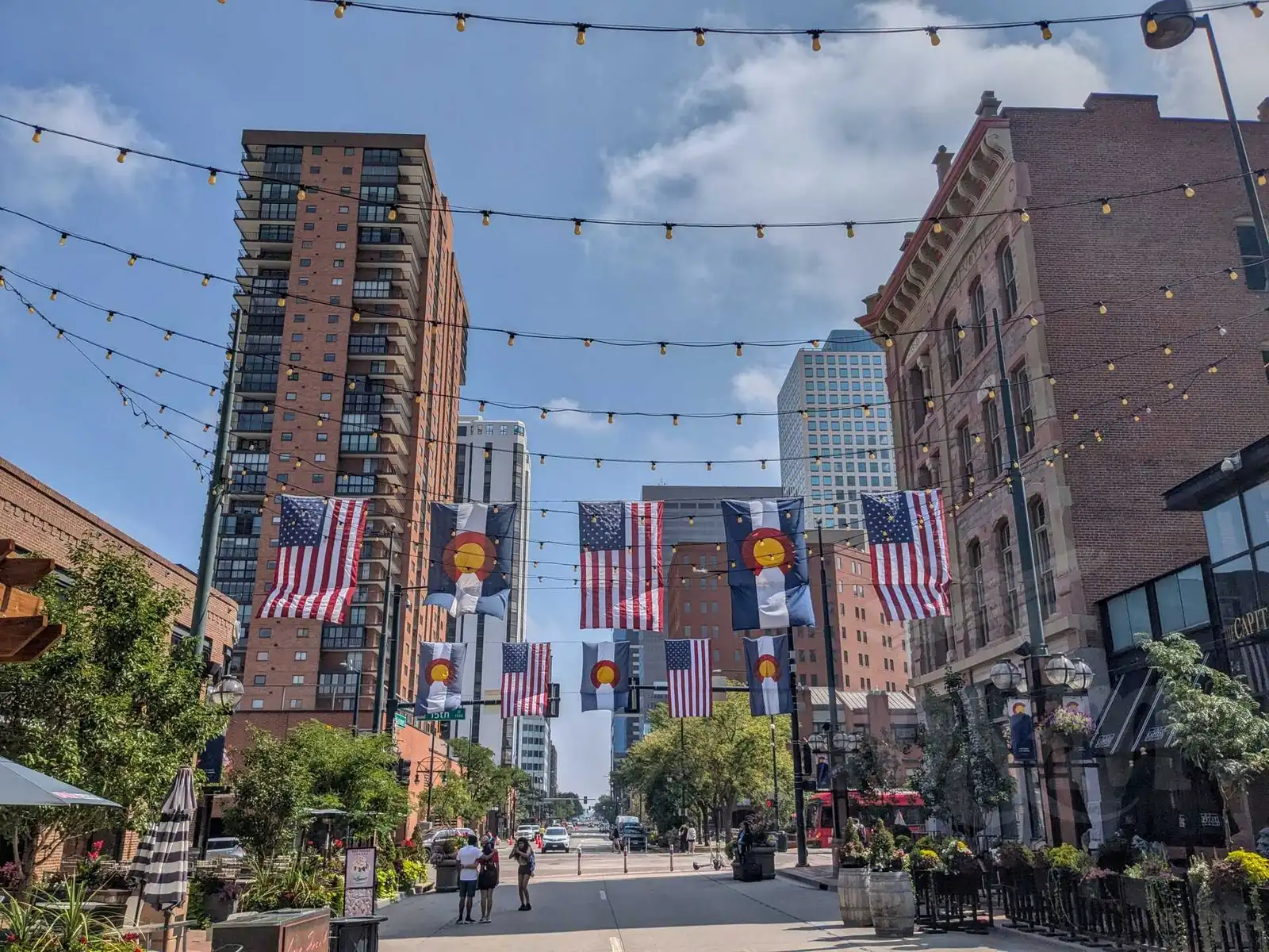
The second day (and the last day of our trip) we didn’t have much planned. We walked from our place to downtown Denver, through Confluence Park. We looked at Larimer Square with the flags, had ice cream and muffins (too sweet). Honestly, Denver didn’t impress us much, it’s a busy city with not much to see. We picked up our luggage outside the station and then took the train to the airport, where we flew to Prague in the afternoon with a short layover in Iceland.
Tips for travelling in the U.S.
Food and Restaurants
Restaurants
- Restaurants are expensive - prices on menus are listed without tax and the almost obligatory tip. Expect a minimum of $25 per meal. Drinks are not necessary, you get water automatically and for free.
- Fast food is significantly cheaper, you can eat for about $5 . A wide variety of chains and types of food.
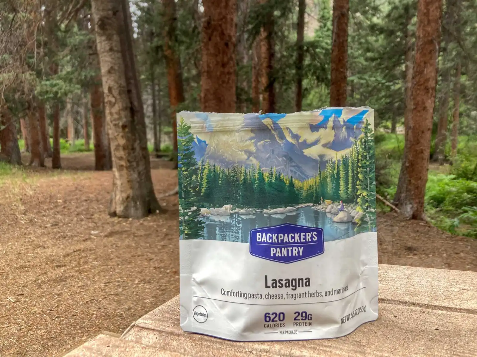
- A good alternative is dehydrated camping food (e.g. Backpacker’s Pantry) - you can buy it e.g. at REI - just pour hot water over it and wait a while. The price also was around $5 per serving.
Tipping in restaurants
- Tipping 15% or more is expected - expect questions from the staff if you tip less.
- Rounding up when paying as in the Czech Republic is not common.
- When paying by card:
- You ask for a bill, hand over your credit card.
- The attendant charges the amount of the meal and returns the card with the receipt.
- You get a pen with the receipt, write the amount of the tip (calculated on the amount without tax).
- You leave the receipt on the table and the attendant adjusts the amount charged to the card.
Vegetarianism vs. Wyoming (and probably other states)
- Vegetarian options are limited. The Taco Bell was the only fast food restaurant where we found a vegetarian menu.
- McDonald’s in the US has a different menu than in the Czech Republic, nothing vegetarian (at least outside the cities).
- Dehydrated camping food saved Magda from starving - there’s a wide selection of vegetarian options.
Shopping in supermarkets
- Small packs don’t exist - most products come in large family packs. Coca-Cola, for example, is sold in packs of 12 or more cans.
- Junk food is significantly more prevalent than healthy options.
- The prices are quoted without tax, the final amount at checkout will be higher (the tax depends on the state and even the city).
Food for trips
- Trail mix (a mix of nuts, dried fruit and chocolate) is great for hiking and you can buy it almost everywhere.
- For non-vegetarians, beef jerky is a good choice.
Car rental
- see our article Car rental in the USA
- If you are under 25, renting a car will be a problem - you will either be refused or pay a hefty surcharge.
- Rental prices change frequently, we recommend checking offers occasionally before you travel and if the price is better, cancel the old booking and make a new one.
- Gasoline in the US is cheap, at the time of our trip it was less than $1 per liter (about $4 per gallon). Cheap gasoline is untouchable in the US.
National parks in the USA
- They are great, cheap and well organized. You get a paper map and park newspaper at the entrance.
- The entrance fee is per car. If you plan to visit at least two parks, the America the Beautiful annual pass ($80) is worth it.
- Car-friendly - the roads are in good condition, and there are many parking lots with restrooms, picnic tables and grills.
- The Ranger programs (guided walks, lectures) are free and held daily in season (see park newspaper).
Accommodation
Inside National Parks and Reserves
- Camps ($35-55/night) must be booked well in advance. Accommodation is available in a tent or caravan.
- Sleeping outside of campsites is not allowed.
- There are hotels and lodges in the parks, but they are few and expensive - hundreds of dollars per night.
- Reservations:
- campgrounds - recreation.gov
- Yellowstone-specific - yellowstonenationalparklodges.com
Outside the Parks
- Hotels and Motels (more expensive option), Airbnb (slightly cheaper option).
- Camps can be found from about $15/night.
- Wild camping is allowed in areas designated as National Forest (we didn’t try it).
How much did it cost us
And how much did it cost us in the end?
Of course a lot of time and nerves in preparation and planning 😀 But from a financial point of view:
We were two people traveling, spent 19 days there and everything together cost us about $5000, at the exchange rate of summer 2024 about 112.000 CZK.
We kept fairly detailed statistics out of interest, so we know how much things cost:
- approx. $1800 roundtrip ticket Prague - Denver with one extra checked baggage (Icelandair).
- $1010 accommodation, of which:
- 3 nights in motels, $370, average $123 per night
- 4 nights in airbnb, $340, average $85 per night
- 9 nights in tent camping, $300, average $33 per night
- $770 per meal, of which:
- $300 for meals for trips booked in advance
- $170 in fast-food restaurants
- $170 in restaurants
- $130 other (grocery shopping, ice cream, coffee, food from stands, etc.)
- $747 for car rental
- $215 petrol for the car (2219 miles or 3570 km driven)
- $170 for entrances and souvenirs - America the Beautiful pass, swimming pool, postcards and other small things
- $135 other - eSIMs, uber, public transportation
- $42 ESTA processing fee
We have once again verified our observation from last year that it is usually the most expensive to get somewhere, while it is relatively cheap to do stuff on the spot. That of course depends on the traveling style, we mainly want to see something, we don’t care much about comfort while traveling (although we don’t want to sleep in the dirt anywhere and luckily that didn’t happen to us).
As for food, we found the camping dehydrated food very good, quite good, filling and ready in 15 minutes. There was also no problem choosing a vegetarian version of it. In restaurants, the total cost would rack up very quickly (we’ve been to fast food restaurants about 10 times, in normal restaurants 3 times and the cost was the same).
We paid for almost everything with our credit cards, we spent less than $20 in cash. Debit card was fine everywhere, we only needed a credit card to rent a car.
In fact, it was cheaper than we expected. When we booked the flights, we figured it might cost a lot more. We definitely don’t regret the trip, we really liked it (especially the nature and parks), the people were nice and friendly. Hopefully we will go back sometime.